Showing posts with label photos. Show all posts

Friday, March 8, 2013

Bathroom Remodel

P1050902There comes a point in time when you realize that you’ve done it—you’ve accomplished your goal. Hot on the heals of my recent kitchen remodel, I put the finishing touches on the remodeling project of my bathroom and just like that, I reached the conclusion of a decade’s worth of home improvement projects on my condo.

In the midst of my kitchen project, I coordinated my efforts with the upgrade vision I had for the bathroom. The vanity was a tired, 30 year-old contractor special that was accompanied by a Boy Scout-built pine box vanity light. The floor had been upgraded to Pergo shortly before I bought the condo, but I was never much of a fan of the wood tone. On the plus side, the toilet, tub, and shower all functioned beautifully and looked just fine to me in their timeless white ceramic color. So while I was ordering the kitchen cabinets, I tacked on a matching vanity with a comfortable 36” height that would no longer make me feel like I was at a sink in a kindergarten bathroom. And with a granite countertop order underway, it was trivial to add matching granite to the vanity, and I decided to add a little modern flare and extra handwashing space with a rectangular undermount sink. In keeping with the contemporary brushed nickel motif throughout the condo, I added a beautiful 8 inch widespread faucet and new vanity light fixture. The demolition of the old vanity happened back in the middle of December which also resulted in the destruction of the old wall-mounted mirror. So when I installed the new vanity, I mounted a new wall mirror and cut a large hole in the drywall and studs for a flush-mount medicine cabinet. The combination of the new fixtures in the vanity space has really transformed the little place where I brush my teeth twice a day and has certainly added value to the condo.

After two disruptive months of construction, I stepped away from my home improvement projects and spent some quality time skiing in the Colorado high country and staying true to my goal of having friends over for dinners in the new kitchen. Still, I knew that I was not quite at the finish line. The Pergo floor still irked me, and I longed for a heated tile floor to complement the one I installed in the kitchen 6 years ago. But I also remembered the challenges I faced when installing the kitchen tile. Rather than procrastinating any more on an inevitable project or getting in over my head, I practiced some humility and maturity by asking for help from my friend and contractor, Matt. Two weeks ago, he showed up early in the morning and within 5 hours, I had a beautifully laid tile floor with thermostatically controlled heating. With each glance at the level, evenly spaced tiles, I remember over and over again that I made the right choice by asking for Matt’s help. After another week of occasional effort, I had grouted and sealed the tile and installed the new baseboard and brushed nickel towel racks. And that’s when it dawned on me, my condo renovation projects were complete!

It has been simultaneously frustrating and rewarding to remodel my condo, but more than anything, it is simply something that I have done. I didn’t just talk about doing a whole bunch of work, I did it. It is so very easy to consider things and talk about things, but to actually do something, that is what I think really counts.

Now that this massive condo renovation project is complete, I realize that I have a great new opportunity to pursue other goals that were lower priority but more interesting. After I finish writing this, I am planning to begin a significant long-term migration and improvement of my website to the web-standard Wordpress platform. That will be an ongoing effort, so I will also get back to achieving autonomous aerial flight with my quadcopter, and if that weren’t geeky enough, I absolutely can’t wait to see how I can incorporate Arduino microcontrollers to completely tech-out my Westfalia van!

Below are a sampling of Before and After photos from the remodeling project. I apologize if it is difficult to see the improvements I made to the bathroom; it’s very difficult to take photos of such a small, cramped space.

Click here to open the Before and After photo album in its own window

Sunday, February 17, 2013

Solar Panels on a Westfalia Luggage Rack

In May of 2011, I embarked on several projects to improve the functionality of my 1985 VW Vanagon Westfalia camper. After installing a Bostig turbo charger and designing & building an Arduino-based battery monitor, I designed and installed a solar panel system to keep my beer cold all summer long. But of course, just as I finished the project, I set out on a 10-day kayaking road trip that was part of my kayaking 100 days in 2011! I always intended to share my experiences with this solar system and after having it installed for almost 2 years, it seems like a great to do so!

I put together a video walk-through of the system, so if you have about 14 minutes and want to see and hear all the nitty-gritty details, have a look below! (If you’d like to watch a 2 minute synopsis, check out the video at the bottom of this post.)

The goal of the solar panels was to allow for continuous use of the 12V refrigerator in my van during the summer months, since that would simplify the need to add or remove items from the fridge. Considering that I am always on the go during the summer, I wanted my van to always be ready to support my next adventure and that meant that the fridge needed to already be cold and stocked with beer! And since the pop-top portion of the roof is always loaded with kayaks and other gear and I wanted the panels to be useable without having set them up and take them down each time, it meant that I needed to mount them on the area over the luggage rack. But wait, I have more requirements! The solar panel also needed to be removable so I could set it in the sun when the van was parked in the shade. And finally, just one more requirement—I wanted to retain partial usage of the luggage rack!

Yes, I was able to meet all of those requirements and am extremely happy with the entire system almost 2 years later. The best way to understand how the system works is to watch the video above, but I thought I’d provide a little bit of detail about the components that went into the system in case you are interested in building something similar.

Finally, I’ve included a few photos that show the solar panel system in action as well as some details of the mounting system.

Click here to open the photo album in a new window.

Update, 2/19/2013:

If you would rather spend 2 minutes instead of 14 to see how the solar panels mount on the luggage rack, check out this abridged version of the video:

Saturday, December 29, 2012

Kitchen Remodel

IMGP0725The thoughts we carry in our minds can be a blessing or a curse. When we cage them, our lives are filled with disappointment and an overwhelming sense of what could be. The thoughts must be set free and this can only be done by making them real.

In October of 2002, I toured a condo with a realtor and knew that it would be the first home I would own. During that tour, I viewed an opening between the kitchen and the dining room and was immediately filled with a vision. I saw the possibility of letting even more light pass between the rooms with new cabinetry and glass doors. I saw an extended countertop that would invite guests to sidle up with a glass of wine while the chef prepared dinner. And I saw my first and most ambitious remodeling project.

Years passed, and although I built an impressive wood working shop in my garage, the kitchen remodel remained a dream locked within the confines of my mind. Then in the winter of 2006 while recovering from knee surgery, I set about the ambitious task of designing and building my first kitchen cabinets. The project took several months of dedicated effort, but I had finally completed the goal I set 4 years earlier. Well, almost. The new cabinetry was a significant personal accomplishment and improvement over the original wall cabinets, but it only represented a fraction of the complete kitchen remodeling project. I told myself that I needed some time to rest and then I would get back to building the rest of the cabinets. And in the meantime, I decided that I wanted to build a whole new bank of cabinets for one of the kitchen walls. Months passed and my saws sat idle in the garage. The day after Thanksgiving, I tore into the kitchen. Actually, I tore up the floor and set about installing a heated tile floor to replace the Pergo. It may not have been cabinetry, but it was at least some sort of progress.

More years passed. Whitewater kayaking took a prominent role in my life. I bought a motorcycle. I sold the motorcyle and bought a VW Thing. I sold the VW Thing and bought a VW campervan. I installed a Ford Focus engine in the VW van. I installed a turbo charger on the Ford Focus engine in the VW van. And I kayaked—a lot. So it’s not that I was sitting around doing nothing, but all the while, my kitchen remained as it had been in 2006. And worst of all, the thoughts—the dreams—pinballed through my mind every time I stepped foot within the kitchen. Finally, finally, in October of 2012, the notion of the kitchen remodel re-entered the forefront of my thoughts. I spent hours at Home Depot with the kitchen consultant and came away with a very large estimate. And that estimate was just for materials and they weren’t even high-end materials. The cost seemed prohibitive and I debated whether the money would be better invested in my current condo or in savings for a future house. But ultimately, it became about something much greater than a financial investment. It became about the thoughts—the goals—the dreams that I had set for myself a decade earlier. I knew that I had to do it. I had to be true to myself and set the thoughts free. I had to make the goal into reality.

So on October 10th, I set the wheels in motion by ordering the rest of the kitchen cabinets from Home Depot. I had learned just how difficult and time consuming it is to build quality cabinetry and also realized that the difference in cost for build-to-spec cabinets was not that much greater than doing it myself. I also sprung for new stainless steel appliances and the luxury ticket item—granite countertops. I attempted to schedule the project to minimize the disruption in my life, but alas, both the cabinet delivery and countertop installation were delayed beyond the initial estimates. So for 2 months, I’ve been living in a state of semi-chaos. I washed dishes in my bathtub for 6 weeks. I ate microwavable dinners and fast food on a daily basis with almost no fresh vegetables. I worked almost every weekend and weeknight on the project. And now I can honestly, proudly say that my kitchen remodeling project is complete! The thoughts have been freed from my mind and they now live in solid form within my condo as my new kitchen. And with that, the curse has been transformed into a blessing.

Below are a sampling of Before and After photos from the remodeling project. I hope you enjoy perusing them and that I can have you over for dinner!

Click here to open the Before and After photo album in its own window

Also, if you are curious, I’ve posted some photos of the project while it was under construction.

Click here to open the Construction photo album in its own window

Thursday, September 27, 2012

JB Westwater Memorial

On June 3, 2012, Jon “JB” Boling died while rafting the Middle Fork of the Salmon River in Idaho. Among the many facets of JB’s life, he had a particularly strong love for whitewater rafting and his friends in the whitewater community. On the weekend of September 22, 2012, many of his closest river friends gathered for a trip down Westwater Canyon in Utah to celebrate and remember JB. For most of the weekend, we partied like we knew Jon wanted us to and on Sunday morning we spent an hour in a spectacular location in the canyon to remember JB. It was a wonderful weekend for his close friends to gather on the river and celebrate life. We still miss you JB.

OLYMPUS DIGITAL CAMERA

In addition to rafting Westwater, about half the group also spent two days floating through Ruby and Horsethief Canyons upstream. Below is a selection of photos from the weekend trip.

Click here to open photo album in a new window.

Earlier in the summer, we had another memorial float through Brown’s Canyon on the Arkansas River and a selection of those photos is shown below.

Click here to open photo album in a new window.

Thursday, September 6, 2012

BVCB Bike Tour

The BVCB gang with Mt PrincetonAlthough the 2012 drought has been less than ideal for kayaking, the upshot has been that I’ve been able to get out on my mountain bike more this year than in the past several years combined. So when my good friend, Scott, suggested a Labor Day weekend bike trip from Buena Vista to Crested Butte, CO, I couldn’t refuse. Originally, he intended the trip to extend from Colorado Springs to Loma, CO (original route map) and to be self-supported (everyone carries all of their own gear), but things don’t always go as planned. Instead, the route encompassed just 3 days of biking on back roads, forest service roads, and single track, and support was provided by a sag wagon.

The BVCB team consisted of Scott, Dave, Mikelle, Carrie, and myself, all of whom had spent considerable time biking and kayaking in Buena Vista (BV) this year. So it was no surprise when all of us convened at Dave and Mikelle’s new house in BV—aka “Dalton Ranch”—on the Friday night before Labor Day in preparation of the BVCB trip. We departed BV by 9:30am on Saturday, 9/1/2012 with fresh legs and high expectations for the adventure before us. Over the course of the day, we passed by the Chalk Cliffs on the side of Mount Princeton, climbed in elevation, and took a respite from the rain in a creepy general store in the little ghost mining town of St Elmo. After the rain subsided, we made the final push up the steep, muddy road past countless ATV’s to a gorgeous campsite that Dave graciously found for us.

We arrived in Crested Butte!The second day of the tour began with an immediate, steep climb up Tin Cup Pass followed by a rocky descent past hundreds of noisy ATVs to another ghost mining town, Tin Cup. From there, we continued down hill to Taylor Reservoir, then along its north shore, and finally up an endless 6 mile climb to another incredible camp that Dave located. On the third day, the morning treated us to a long downhill ride to our turn off to the singletrack trail known as Deadman’s Gulch. We chose to follow the Rosebud Trail which quickly ascended into alpine fields before intersecting the Deadman’s Gulch trail that switchbacked dozens of times through glades of aspen trees on a steep hillside. After the adventurous singletrack, we found ourselves on a 7 mile dirt road descent that finally led to another 7 mile slog into the wind along Highway 135 into Crested Butte. We arrived 3 days and 90 miles after we left BV and immediately celebrated with pizza and beer at a hole-in-the-wall joint where we reveled over our accomplishments, reminisced about the wonderful times we had, and planned our next biking exploits. Without a doubt, there will be a sequel to this story…

I’m sure that you want to check out the photos and maps, so here they are. But if you want to hear a little bit more about the geeky side of this trip, keep reading below!

If you have spent any time reading my stories on this site, you know that I can’t leave home without an arsenal of gadgets that help me tell my stories and this adventure was no different. By some measures, I was traveling light on gadgets, but nonetheless, I had a GPS and SPOT mounted to my handlebars for location recording and real time broadcasting of our location. There was also a portable, waterproof sound system (ECO Extreme) with my iPhone safely encased on my handlebars that cranked out tunes for all of the long climbs along the trip. And finally, I tested out a small solar panel system by Goal Zero that powered the GPS and charged a battery pack. Overall, the gadgets performed beautifully, although they made my bike a bit cumbersome to handle on the tight singletrack trails.

So what did all of these gadgets actually do? Well, the SPOT provided real time tracking of our location every 10 minutes which was displayed at this Spotwalla webpage, and allowed me to check in on Facebook with our status even when we were far out of cell phone range. While this may have not been critical for this trip, the ability to practice with the device and know that it had its “SOS” capabilities made it worth carrying and using. The GPS provided our cumulative distance, elevation, and speed to evaluate our progress during the trip, and it also recorded a track log and waypoints for post-trip analysis. The simplest form of our track and waypoints is contained with the BVCB GPX file that I created, but for the less initiated, I also uploaded our route to my Garmin Connect site and a new site called Garmin Adventures. One of the cool features of the Garmin Adventures site is that it allows for photos and videos to be included along with the map in a format that other users can download to their PC or GPS.

Of course, I also had my little waterproof Panasonic DMC-TS3 camera along for the ride and managed to snap about 200 photos which provided a perfect excuse to start learning to use Adobe Lightroom. The great thing about Lightroom is that it consolidates tasks that I have previously accomplished via several tools into a single, professional-grade piece of software. After importing the photos, I was able to review, rate, select, and make adjustments on the photos. Finally, I was able to create “collections” of photos that I was able to use to create photo galleries for the web and publish to Facebook. So far I am extremely happy with this new addition to my digital life!

Sunday, March 25, 2012

New Zealand

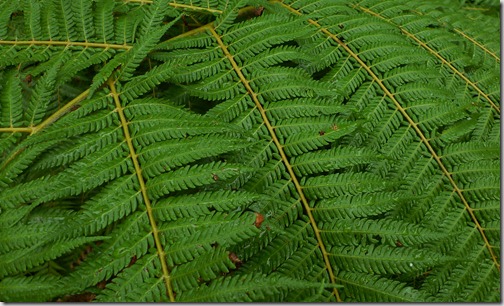
The ubiquitous fernThe grass is always greener on the other side. No where does this expression hold more truth than Antarctica where grass has not existed for eons. Not surprisingly, visitors to the white continent spend much time daydreaming of their return to a place where the grass is greener both literally and metaphorically. And since Christchurch, New Zealand is the port of call for Antarctic redeployers, it’s only fitting that many dreams take shape in the land of the Kiwis.

Vegetation, warmth, and water all occupied my post-McMurdo fantasies, so after I returned from the Ice, I promptly began my journey to explore the idyllic coast and beaches of New Zealand’s south island. My plan was to tour the south island of New Zealand for 4 weeks in a counter-clockwise direction with a focus on the warm coastline in the northern part of the island followed by exploration of the world renowned, rugged mountains in the southern part of the island. Half way through the trip, my Colorado kayaking buddy, Robert Baca, would join me on the west coast with hopes of some Kiwi kayaking followed by hiking and plenty of adventure. Apart from meeting Robert on February 18th and flying out of Christchurch on March 5, my itinerary was completely open and I was all ears to suggestions from others who had already enjoyed this wonderful island.

P1000884

I began my journey on February 7th by heading to the small coastal town of Kaikoura a few hours north of Christchurch and was fortunate to enlist the company of two Antarctic friends for a few days of company and readjustment to life in the real world. Our days were blissfully lazy, but we still managed to explore the rocky shores via surfboard and hike through the forested hillside before they headed back to the States.

After their departure, I found myself on my own for the first time in months as I continued to follow the road north. The romantic notion of independent travel is always balanced in reality with intermittent feelings of loneliness, but fortunately for me, a quick stop on the coastal drive led to a dozen New Zealand fur seals that captured my attention fully and marked the beginning of my solo travels.

I continued north along the coast to the Marlborough region known for its warm, sunny weather, vineyards, and maze of waterways. While perusing the Lonely Planet guidebook in McMurdo, I came upon a description of a coastal hiking trail in the Marlborough Sounds that offered the best of wilderness and civility. The Queen Charlotte Track meanders along steep, vegetated hillsides for several days of enjoyable hiking. But rather than carrying food and camping gear for the entire duration, the trail takes advantage of numerous, isolated hotels that are only accessible by boat or trail. Among the hotels, the Furneaux Lodge particularly piqued my interest with descriptions of its soft grass lawns that lead to the water and its mouth-watering restaurant and bar.

P1040104_thumb8So on February 10th, I departed the port town of Picton on a water taxi to the start of the Queen Charlotte Track in historic Ship Cove where Captain Cook moored his ships on several occasions in the 1770’s. With little need for food or sleeping gear, I set forth from the cove with a light pack on my back and began an immediate ascent of the heavily forested hillside that was dotted by grand old beech trees among New Zealand’s national symbol, the prolific fern. After noticing a distinct lack of animal and even insect life, a deafening cacophony filled the air from locusts that were at once everywhere and nowhere. Several hours of hiking later, I came upon an idyllic flat, low location at the sheltered end of Endeavor Inlet which housed Furneaux Lodge. I must admit that the cool, wet weather didn’t match my daydream of lounging on the grass by the water, but it did provide an ideal reason to escape to the gorgeous Victorian retreat where I read my book, played the piano, and enjoyed a satisfying meal of mussels, seafood chowder, and Sauvignon Blanc before retiring to my bed in the stone barn known as The Croft. The following day’s weather hinted at improving conditions, but the sun never really made its presence known during several more hours of hiking before I boarded the water taxi back to Picton and my next destination.

The locals all claimed that rain and overcast weather were completely uncharacteristic for the Marlborough region during their summer, but when I told them I was driving to Nelson to the west, they all but guaranteed fair conditions in “Sunny Nelson”. Compared to the isolation of Antarctica, the tiny towns of Kaikoura and Picton, and the solitude of the Queen Charlotte Track, Nelson felt like a bustling hub-bub and reminded me a bit of suburban Boulder, Colorado. It only served as a pit stop in my journey, but I took advantage of the blue skies and warm temperatures by fulfilling a long-time dream to soar through the sky in a paraglider. The experience was completely surreal with the ground moving slowly below me as I was suspended beneath the large aerofoil with an expert pilot at the controls. Although I thoroughly enjoyed the experience, it was not the life changing moment that I thought might divert my spare time towards a new hobby.

P1040172

Nowhere on New Zealand’s south island is better known for warm, sunny beaches than Abel Tasman. The national park is named for the Dutch commander who first discovered the south island in 1642 and extends north along the coast away from Nelson and affords incredible opportunities for exploration by foot or sea kayak. Spaced thoughtfully along the coast are a network of Department of Conservation (DOC) huts that eliminate the need to carry a tent or sleeping pad allowing for light travel and enhanced enjoyment of the tropical setting and azure waters. On February 13th, I boarded a water taxi from the small town of Marahau in order to shorten the track length into a timeframe before Robert’s arrival. An hour later, I began tramping at low tide in Bark Bay and made haste to reach the Onetahui tidal crossing before it became impassable. In contrast to my previous hike, the weather was beautiful and I was definitely not disappointed in the famous aqua marine waters. As another example of the civility that I enjoyed along New Zealand’s tracks, I stopped mid-day at the barely accessible Awaroa Lodge for a beer and allowed myself to relax a bit. However, the stop allowed time for the tide to rise which resulted in having to wade through water for a kilometer to reach Awaroa Hut where I spent the night sheltered from the rain.

I rose early the following morning in order to make the 1 kilometer crossing of Awaroa Inlet at low tide which would be absolutely impossible when high tide adds 10-12 feet of depth to the inlet. With no time commitments and soothing overcast skies in the morning, my mind completely relaxed for the first time in months as I hiked through primitive forest high above the water. Throughout the day’s hike, landslides were evident as a result of more than 20 inches of rain on Christmas day. As I moved north, my body protested with an upset stomach that slowed me to a near standstill and ultimately forced my to rest in the sand at Anapai Cove as the sun returned to the sky. Still under the weather, I trudged on towards my next hut, but was forced to rest in the shade of two huge sequoias that stood as sentries on the beach in beautiful Mutton Cove. By 6pm, I reached Whariwharangi Hut, cleaned myself up, quickly fell asleep in the spooky old farmhouse.

My stomach felt remarkably better on my third day, and I headed south retracing my steps in order to reach the water taxi at Totaranui. However, I followed a welcome detour to Separation Point that stands as a high, rocky promontory above the water and is home to seals and cormorants. The sun was out in force for most of the day, and my sweaty t-shirt attested to the fact that I finally found the warmth that I longed for in Antarctica. As I spent the last hours wandering back towards Totaranui, I came upon secluded sand beaches that were out of a dream and took advantage of the incredible setting with a quick dip into the blue waters in tiny cove next to Anapai before my rendezvous with the water taxi.

Click here to open Abel Tasman slideshow in a new window.

P1040347Having completed my exploration of the northern coastal region, I headed south along a picturesque back road that wound its way along a river and through organic farms before finally arriving at the remote town of Murchison. Generally unknown by tourists, the little hamlet is centrally located among dozens of whitewater rivers and is home to the only company that rents whitewater kayaks on the south island. On February 16, I met up with legendary kayaker Mick Hopkinson at his grassy retreat, the New Zealand Kayak School and promptly began to arrange rental of kayaking equipment. With his assistance, I met three kayakers from Idaho who were in the area and coordinated to join them on a few stretches of the local Buller River. The green waters and mellow rapids of the Class 3 O'Sullivans and Earthquake stretches of the river provided a perfect transition back into a kayak after months away from the sport. But with low flows in the area and nowhere else to rent a boat on the south island, my pleasant day on the Buller turned out to be my only whitewater kayaking experience in New Zealand.

The next day I followed the Buller River along its course once again, but this time I was in my little white Nissan rental car and continued until I reached the west coast near Westport. I continued south along a coastal road that Lonely Planet declared as one of the planet’s 10 best road trips. Suffice it to say, the views were absolutely spectacular and I found myself stopping the car constantly to snap photos. Robert arrived the same day and hopped a bus west across Arthur’s Pass, so I proceeded onward to Greymouth for our rendezvous. With a few hours to kill in the coastal town, I made my way to the small surf beach and after a few minutes of small chat found myself surfing the small waves under the warm sunshine on a borrowed surfboard and wetsuit! My surf session soon ended and I found Robert in the nearly abandoned downtown of Greymouth. The spectacular coastline had made quite an impression on me, so we hopped in the car and headed north to revisit the sites under the evening light. The Punakaiki Rocks are limestone that has been worn away to resemble stacks of pancakes among the crashing surf and provide wonderful photographic opportunities at any time of day, but particularly at sunset.

Click here to open Punakaiki slideshow in a new window.

Although I had a few activities in mind for my New Zealand trip, this was one of the few vacations where I was open to random opportunities as they presented themselves. And so when Robert suggested that it might be fun to hike to some caves near Punakaiki, I figured, “Why not?” and wound up having one of the coolest experiences of the entire trip. Fox River Cave is reached by a 4 mile hike along and through the Fox River, followed by a short, but steep ascent of the limestone valley walls. Apart from a few cliff overhangs and a guided tour of Lehman Caves in Great Basin National Park, I had never explored a cave and was in for quite a treat. The official opening matched one’s expectations, but around the corner I found another small entrance and decided to explore it while Robert proceeded down the main passage. A minute later, I reached an impassable constriction but suspected that it would lead to the main tunnel. I shouted to Robert who was able to hear me on the other side of the impasse and eventually had him verify that he could see a few rays of my headlamp beyond the constriction. I stared at the tiny opening and then at my torso and began to contemplate what seemed impossible. A minute later, I shouted to Robert that I was going to attempt to lay my body on its side and squeeze through the claustrophobic aperture. He obviously disapproved, but at least if I got stuck, he would be able to hike out to get help. The squeeze was absolutely ridiculous, but moments later, I was on the other side, muddy but safe! My mind was blown and I felt like I could really get into this whole caving sport. Almost immediately thereafter, we witnessed stalactites clinging to the ceiling and stalagmites standing proudly on the floor of the tunnel. With every twist and turn, the cave revealed new mysteries and beautiful sights that left me fully entranced. Although we had been told that the cave was only 150 meters deep, we somehow managed to spend over 2 hours exploring its reaches including a hidden passage that seemed to rarely see visitors. I was absolutely thrilled about the experience even well after we left the cave and was fortunate that Fox River was just the first of several cave explorations during our New Zealand visit.

Click here to open Fox River Cave slideshow in a new window.

On February 20, we continued south along the coast and made obligatory visits to the touristy Frans Josef and Fox glaciers. The following day began with a steady rain that we hoped would recede in appreciation of the long day we had ahead of ourselves hiking the Copland Track. But as fate would have it, the rain maintained its constant onslaught for the duration of our long day on the trail which resembled a streambed much more than a track through the woods. The landscape of the south island’s west coast is home to temperate rain forest, and 8 hours of hiking through the temporary streams and soaked to the bone gave us a true appreciation for the term rain forest. A little more than half way through the hike, we rounded a corner and were shocked to see where the trail led. The path abruptly ended at the edge of a raging class V creek and didn’t resume until 200 feet across the ravine. In between, a shaky, metal foot bridge was suspended above the torrents of Architect Creek. We traveled one at a time across the bridge knowing that a fall would be fatal, but trusting that engineers had properly designed the structure. Having spent countless hours staring at rapids from shore and from my kayak, it was fascinating to examine them from directly above. A few hours later, we came upon a second swing bridge that was lofted 80 feet above Shiels Creek. I was shocked that none of the rangers had even mentioned these litigious bridges and could easily imagine an acrophobic hiker reaching the bridges and immediately turning back rather than continuing on. It would be a shame to turn around so close to Welcome Flats though, since a wonderful hut and natural hot springs reward the weary traveler who makes it past the perils of the trail. Soaking in the hot springs with a glass of red wine and watching waterfalls on the steep valley walls made the entire hike worth it. And when we hiked back out the following day, I was struck with a weird feeling. I realized that despite the temporary misery of hiking through the rain, I had truly enjoyed the experience and felt that hiking in fair weather was not nearly as satisfying as experiencing the land when it was alive with its essence.

Click here to open Copland Track slideshow in a new window.

With blisters on our feet and sore legs, we drove south to the lakeside town of Wanaka hoping to escape the rain, but instead resorted to relaxing for the day and accepting the incessant fall of water from the sky. On February 24th, we left Wanaka and drove along a dirt road complete with water crossings into Aspiring National Park. The road coursed through spectacular fields of sheep set among cliff walls and glaciers in the distance. When the road ended, we shouldered our packs once again and headed up a stunningly beautiful trail for two hours to Rob Roy Glacier where we cracked open Speight’s beers and picnicked in the sun directly beneath the glacier.

Click here to open Rob Roy Glacier slideshow in a new window.

P1010086Traveling south from Wanaka, we spent an obligatory day at the adrenaline capital, Queenstown. In the morning, we took an action packed ride on a jet boat through Shotover Canyon. After lazing away the early afternoon on a green lawn in town listening to live acoustic music, we checked out some adventurous souls who plummeted off Kawarau Bridge where bungy jumping was born in 1988, and then it was back in the car moving south to the town of Te Anau.

On February 26th, we changed course and drove northwest along a spur road directly into the heart of Fjordlands National Park to one of New Zealand’s most famous natural landmarks, Milford Sound. Cloudy skies and rain followed us once again but were to be expected in the third rainiest location on the planet. Fortunately, the rain and clouds lifted when we reached the sound and those that remained provided a mystical presence to the special place. The next morning, we woke before sunrise and gathered with a small group to explore Milford Sound by sea kayak. The morning was cloudy, but the water was absolutely still with no wind or waves to impede our progress. Half way out of the fjord, we paddled directly under a waterfall that was hundreds of feet high that created powerful winds that could easily flip an inattentive kayaker. Fortunately, we stayed upright and continued our paddle through the fjord towards the sea and were treated with views of fur seals as the sun slowly returned to the sky. By 1pm, we had completely exited the fjord and were picked up by a motor boat that whisked us back to the start. At that point, the clouds had completely lifted and we were treated to unimpeded views of Milford Sound including impressive Miter Peak high above all.

Click here to open Milford Sound slideshow in a new window.

We awoke early on February 28th and boarded the first water taxi under cloudy skies across Lake Te Anau to Brod Beach to begin our hike of the 4 day long Kepler Track. The trail immediately ascended the reaches of the mountain range, and we proceeded with slow, lethargic plodding through forest for 3 hours before reaching tree line. Just before leaving the forest, the sky seemed to open, the sun began to shine, and we realized that the clouds had not cleared, rather we had climbed above them. Above tree line were beautiful alpine tussocked grasslands with great views of Lake Te Anau below and mountains as far as far as the eye could see. A short distance further along the trail sat Luxmore Hut with all of the aforementioned views which we enjoyed from picnic tables with our lunches and Speights beer. The following day’s forecast called for rain, so at the warden’s prompting we continued further up the trail to Luxmore Summit to photograph the mountain ranges while they were still visible. After dinner, most of the hut visitors read their books or turned in to bed, but Robert and I took our second side trip of the day in order to explore Luxmore Caves. Stories of the caves from others in the hut did not inspire confidence, but since we were experienced cavers, we knew we would be up to the challenge. We hiked and squeezed our way down the main passage for an hour before eventually reaching terminus of the channel and heading back for a restful night in the hut.

True to the forecast, the next day was rainy and cold and conspiring to spoil our day of hiking above treeline. Fortunately, the rain and wind remained light during the trek and the visibility actually afforded nice views of the surrounding landscape. After 5 hours of hiking including a steep, switchbacked descent, we reached Iris Burn Hut and settled in just as the rain began to really pour down from the sky. The third day of the Kepler Track meandered slightly downhill through mossy forest with ferns covering the ground. The uneventful day led to Manapouri Hut on the shores of the lake of the same name where we relaxed and chatted with the hut mates we had befriended the previous several days. We began the final day of the track early in the morning and made it to Rainbow Reach where I hitched a ride back to town retrieve the car so we could make haste to our next destination to the south.

Click here to open Kepler Track slideshow in a new window.

Enjoy the 360 panorama from Luxmore Summit!

With only a few days left in New Zealand and having just completed the Kepler Track, we sped south to tour the remote coastal region known as the Catlins. As we neared the coast, we couldn’t help but stop at the roadside Clifden Caves, but the 45 minute exploration revealed graffiti and wear and tear that our previous caves were not subject to in their remote locations. Pushing on, we made it to Curio Bay just before sunset and were able to view petrified trees in the sea rocks and a few yellow eyed penguins while an Antarctic southerly pounded the coast with rain and wind. The next morning, we explored Slope Point that enjoys its claim as the southern most point of the south island then hopped into the car and moved east until we reach Surat Bay where we explored the beach and photographed sea lions. Driving further east, we made our last stop in the Catlins at Nugget Point where we hiked to the lighthouse and photographed scenery and sea lions hundreds of feet below at the base of the cliffs. We then departed the desolate Catlins and slowly began our return to civilization when we reached the university town of Dunedin. Having selected Speights as my official New Zealand beer, I couldn’t resist the brewery tour which concluded with 30 minutes of open bar that prepped us for a fun night on the town to celebrate with the locals who had just won an intense rugby game.

Click here to open Catlins slideshow in a new window.

After 4 weeks of exploring New Zealand’s south island and 2.5 months away from home, I found myself back in Christchurch where I began my Antarctic and New Zealand journey. Typically, the end of my travels are filled with with sadness of departure and wishes for just one more day, but as I boarded the plane in Christchurch, I was overcome with excitement to finally be returning home. In spite of the amazing adventures I had in Antarctica and New Zealand, I longed for the place that I truly feel happiest. Of all the aspects of this amazing journey, I realized that what mattered most was that I was able to walk away from my day-to-day routine, step into a completely different world, and return more grateful than ever to the life that I have been blessed with in Colorado and the good ole U-S-of-A.

Saturday, February 4, 2012

Stranded

P1030909The Ross Ice Shelf is the largest ice shelf not only in Antarctica, but the whole world. In contrast to sea ice that is formed when sea water freezes on the surface of the ocean, ice shelves are created when glaciers flow from their land-borne origins to the sea. Upon reaching the sea, they maintain their ties to the land but begin to float on the sea water. Almost the entirety of the Ross Sea coastline in Antarctica is fringed by ice shelf and the resultant area of the 100 to 1000 meter thick ice shelf is equal to that of France. The very fact that an ice shelf rests on the sea surface means that it is completely devoid of any vertical features. Like so much of the interior Antarctic Plateau, the Ross Ice Shelf is simply white, flat snow as far as the eye can see.

The first three ozone station installations took place in spectacular, mountainous settings representative of the Antarctica that nature documentaries love to share with the world. But in reality, most of the continent is stark white and featureless. So while it was a joy to explore the regions along the Ross Sea of Marble Point, Minna Bluff, and Cape Bird, there was a looming sense that we had not yet glimpsed the real Antarctica. But on Thursday, February 2, we departed McMurdo via a Bell 212 helicopter bound for our fourth and final installation on the blank, white Ross Ice Shelf at a location called Lorne where a University of Wisconsin automatic weather station (AWS) resides.

The helicopter left our familiar McMurdo residence and headed south, quickly passing our previous bounds of exploration of Happy Camper School and the Windless Bight installation. The helo pilot pointed through the windshield and announced over the intercom that we were paralleling a linear track in the snow below known as the South Pole Traverse route. The United States Antarctic Program (USAP) has maintained a permanent base at the South Pole since 1956 and as you can imagine, such a remote and extreme location requires prodigious resources to operate throughout the year. In addition to aircraft support, South Pole Station receives a significant annual resupply via ground vehicles that determinedly trudge their way from McMurdo across the vast continent to the point where all lines of longitude intersect. We followed this impressive track into the white unknown at 130 miles per hour and, after 25 minutes, deviated towards the AWS site.

In the final minutes prior to touchdown, the helo pilot cautioned us of the local weather conditions, saying that it appeared that a front was approaching and that visibility could possibly be reduced so low that helicopters could not fly. Compared to closed-support trips where the helicopter stays with the scientists in the field, our open-support trips consisted of drop offs from the helicopters followed by 6 hours of ground work and finally, pick up from the helicopters. And whereas most open-support flights are conducted at established field camps meant to support weeks or months of inhabitance, our Lorne location was completely isolated on the Ross Ice Shelf with not a hint of life for 50 miles in any direction. This very aspect of the campaign was described by Lars to me back in July of 2011, and I found it highly compelling that the work not only had a clear scientific purpose, but an adventurous risk to it. And so it was without surprise that we heeded the pilot’s advice carefully as we parted ways with the chopper.

Our skills were well honed from multiple assembly/disassembly cycles of the ozone stations, so we proceeded rapidly with the installation in hopes of accomplishing at least part of the work before the weather could take a turn for the worst. In the midst of our busied efforts, I was taken aback by the vast expanse of white in which we stood. Pausing for a moment, I took out my camera and snapped a photo of our two survival bags against a backdrop of endless ice shelf in a foreshadowing of the events to come.

Even as our work progressed, we were mindful to keep tabs on the sight of White Island far in the distance as an indicator of the relative visibility. After a few hours, Lars dutifully radioed the helicopter dispatch to notify them of our deteriorating conditions with reduced visibility to White Island, but they replied that since all the helicopters were engaged in other activities, there was no immediate opportunity for pick up and we resumed our efforts. Not long after, the radio buzzed to life and announced to all stations that the ice shelf air fields had been declared Condition 2. McMurdo operations employ a method of describing weather conditions as a means of evaluating the ability to safely perform work outside. Our entire time spent on the continent had consisted of Condition 3 which is the most benign category, whereas Condition 2 indicates high winds (48-55 knots), cold temperatures (-75F to –100F windchill), or low visibility (<1/4 mile), and Condition 1 represents the most deplorable possible state of existence. Even in our present environment, the Condition 2 announcement was able to send a chill down my spine.

For the first time since our arrival in Antarctica, we were truly vulnerable. Providing solid leadership in response to the fact that we would not be retrieved by helicopter on schedule, Lars declared, “It may be an extra 2 hours or 2 days we are stuck here, so we need to prepare for the worse.” His advice was honest and to the point; from that point forward, we had to be particularly conscientious of our every action if we were to brave the elements on our own.

In almost no time, the installation was complete while our weather had remained pleasant with slight winds, sunny skies, and good local visibility. Fifty miles away was a different story. Visibility in McMurdo remained poor as were our immediate prospects of return to town. At regular intervals, Lars contacted helo ops using our VHF radio that employed a repeater on Mount Terror to relay the radio signal back to McMurdo. During one of these communications, helo ops and then MacOps each declared that our transmissions were broken and unclear. Switching to the back up radio, he tried radioing again, but to no avail perhaps due to issues with the repeater station. Without radio communication, our prospects were looking much grimmer. Fortunately, we also had an Iridium satellite phone which he used to call back to base. As I stood nervously eavesdropping on his conversation, the situation took yet another turn for the worse. As he described the communication schedule we would follow, the phone’s battery died, and our lifeline was left without knowledge of our path forward. Redundancy is a wonderful thing and as proper planning (Lars) would have it, there was a spare Iridium battery that was quickly swapped to regain communication with base. A communication schedule was quickly established with McMurdo, the phone was powered off in an effort to conserve battery life, and we were left to fend for ourselves for the short term.

An incessant wind blows unimpeded across the Ross Ice Shelf from the south that quickly robs heat from anything in its path while providing a beautiful dance of blowing snow across the ground. In its opposition that afternoon, a bright sun warmed our faces when we turned our backs to the wind. And so following instructions from Happy Camper School a month earlier, we set our shovels into motion and into the Styrofoam-like snow to build a couch set down below the surface. The snow we removed was stacked carefully on the windward side of the couch to form a wall that reduced the effect of the 20mph wind to nothing. We settled proudly onto our newly built furniture, soaked in the rays, munched on deli sandwiches, and Sam even launched a colorful kite into the sky. Our departure was delayed, but we were extremely comfortable in our little outdoor living room and in great spirits to wait a few hours for the copter’s arrival. The hours passed and our restless, creative personalities set us each on tasks that invariably involved digging in the snow and fortifying our little shelter.

As our shovels chopped and dug at the snow, we received an unexpected visitor in the sky. Rather than the helicopter that we hoped would descend upon us, the most prevalent Antarctic bird of flight, the skua, had somehow navigated dozens of featureless miles across the ice shelf to our precise location. Perhaps it was drawn by the kite in the sky or by the smell of our snacks, but in any case, it was comforting to see another sign of life in our desolate, isolated situation. The journals of great Antarctic explorers reported great excitement upon sight of such an animal when in dire conditions, and after this little guardian angel graced our presence, I felt a deeper appreciation for the thoughts and emotions that these men must have experienced.

Time passed slowly until the hour of truth finally arrived. At 8pm, Lars made the call back to helo ops to assess our possibility of being retrieved. Although we had discussed and strongly considered the possibility throughout the day, it was not until that phone call that we realized our actual predicament. Conditions had not improved, no helicopters would be flying to pick us up, and we were going to be force to spend the night. In short, we were stranded.

It is one thing to be stranded in the States where AAA or a police officer is a cell phone call away, where weather is generally favorable, and where we are comfortable in our backyard. But to be stranded on the Ross Ice Shelf in Antarctica is something altogether different. To be left so isolated and so vulnerable in such a harsh environment, one could easily be reduced to tears and quickly succumb to the conditions. Fortunately, the United States Antarctic Program  (USAP) recognizes these very real risks and goes to great lengths to minimize their impacts when they inevitably happen. For one thing, we were well equipped in our extreme cold weather (ECW) equipment that every participant must wear on aircraft flights. Second, we were well trained to handle such a situation during our mandatory Happy Camper School. And finally, we had our requisite survival bags that are dropped with all team members on open-support helicopter flights.

P1030931So after concluding the satellite phone conversation, we embarked on the uncommon act of opening and using our survival bags that contain tents, sleeping bags, stoves, cookware, emergency food rations, and various assorted items. Since we had already spent our previous waiting hours in the construction of a snow cave and snow wall, our shelter was nearly complete apart from the tent that I decided to sleep in. With our shelter accounted for and our bellies empty, the next order of business was filling them with warm fluids and replenishing calories. Minutes later, the Whisperlite stove roared to life, snow was melting into water, and we were well on our way to providing for all of our basic needs. Although the survival bags are certainly sufficient to bivouac for the short term, they are aptly named and the culinary experience is of the utmost simplicity. Daily rations consist of a freeze dried backpacker dinner, three survival hard tack bars, and a chocolate bar per person per day. Among the assorted dinners was a crowd unfavorite from Happy Camper School, Black Bart’s Chili. While the packaging of the chili had been comically rebranded to express its expected flatulent quality, Sam and I suspected that the Happy Camper prejudices against this meal might be unwarranted and decided to give it a try. Whether it was the survival scenario or just the right balance of spices we may never know, but both of us were shockingly pleased with good ole’ Black Bart’s Chili.

P1030934 (2)By the time we finished dinner and melted enough snow to maintain our hydration, the clock had advanced to almost midnight and the sun had progressed across the sky to a perfect position among the clouds to amazed us all. A sun dog arced around the sun in a partial circle from the ground up to the blue sky while a beam of light projected directly down to the snow below. It was a little blessing to be stranded in such a forsaken place and witness an event that even left my two atmospheric scientist friends in awe.

The long day’s work in the snow had taken its toll, and I gladly collapsed into my down sleeping bag for a full night’s sleep that was uninterrupted until my watch alarmed at 7am in preparation of the next scheduled call back to helo ops. Any hopes of retrieval were quickly dashed when I poked my head out of the tent into near white out conditions. Nonetheless, Lars made the satellite phone call and learned that conditions in McMurdo had improved markedly in spite of our locally deteriorating conditions. While the news was somewhat frustrating, the next call was agreed to occur at noon and we retreated to our shelters for additional rest. As the morning progressed, conditions improved enough to allow us to leave our shelters, and we were finally able to melt more snow. Meanwhile, Sam bravely tore open the aluminum packaging of the Coast Guard approved emergency food rations and discovered that the thick, blocky rations were actually quite palatable with a taste that reminded me of a lemony, Crisco-y, sugar cookie. The quick brunch was followed by more napping in our shelters and reading books that were thoughtfully included in the survival bags.

P1030939Noon check-in time came and our local visibility was still poor, but the call was made and the next check-in arranged for 5pm. We had been at the Lorne site for 26 hours and it was becoming apparent that it might be several days before a helicopter could reach us. Furthermore, there was the possibility that the weather could remain poor and a helicopter could not reach us for much longer. While we were comfortable in our present shelters, it was becoming obvious that the survival bags were meant for the short duration with food and fuel for only 3 or 4 days. Once more, we retreated to our shelters and passed the afternoon like Weddel seals. Following the example of the seals, they in their thick coat of blubber, us in our tubes of down, we emulated their minimal motion on the ice as the best way for mammals to survive in the harsh conditions.

5pm arrived but improved visibility did not. The call was made and an arrangement was struck. If we noticed improved conditions before the helicopter night shift ended at 11pm, we would call helo ops and they would see if they could send a copter. On the other hand, if a pilot decided that conditions were favorable, we would simply hear an approaching helicopter and would quickly break camp to our welcome retreat. If neither of these conditions were met, we would call the following morning at 7:30am to tag up.

We resumed resting like seals for a few hours followed by our second warm, dehydrated dinner at Lorne. This time, I fondly revisited my old friend Leonardo da Fettuccini while we each studied the horizon to the north. Our local visibility was good, but the long view to White Island was still unimpressive. Still, we maintained our patience and optimistic outlooks. In order to provide a helicopter sufficient time to reach us, we needed to alert helo ops by 9pm if a window of opportunity was present. As the time approached, we could barely make out the flanks of White Island, but the visibility waivered and we decided to wait until the morning for better weather.

We were preparing ourselves for second night bivouacking on the ice and the reality was that we could only continue on our present course for two more days. We discussed the possible options if a helicopter could not reach us in that time. Walking 50 miles across a crevasse-ridden ice shelf was clearly out of the question, so we were completely dependent on rescue from McMurdo. Perhaps a twin otter airplane could land in more difficult conditions than a helicopter or at least drop food and fuel. If not, our close proximity to the South Pole Traverse route provided a reasonable location for a ground rescue by a search-and-rescue tracked Hagglund equipped with ground penetrating radar for avoiding crevasses. Regardless of the method, we all agreed that this topic need to be broached during our satellite phone call the next morning.

With these heavy realities in our minds, time and the sun advanced to the location in the sky where the previous night’s sun dog had occurred. On the second night in a row amid the blowing ground snow, the ice shelf and the sun treated us to an atmospheric delight but this occasion presented two concentric sun dogs nearly circling the sun. While our situation was serious, the beautiful phenomenon in the sky provided great encouragement before we headed back to our shelters for our second night on the ice.

P1030948The stark Antarctic environment is rich in some qualities and almost completely devoid of all others. Sight is filled with blinding white, while colors are limited to the blue of the sky and browns of the barren rocks. Smells are almost completely nonexistent. Sounds belong solely to the wind and that which it blows. In our camp, the wind flapped my tent and caused the rattling of the rime ice cups on the ozone station. And every 15 minutes, the ozone instrument sprung to life with a predictable buzzing tone of its pump. These sounds and no others had filled my ears as I rested in my tent the entire day, but as I was drifting off to sleep at 10:47pm, a new hum entered my brain. With little else to occupy my thoughts, I locked onto this faintest of sounds and imagined the best. My heart began to race faster and the sound seemed to increase in amplitude prompting me to pop my head out of the tent. A minute of careful listening later, and there was no doubt in my mind. Excitedly, I shouted to my compatriots in the cave below, “A copter is coming! A copter is coming!” In short order, Lars had raised them on the radio and confirmed that they were on their way to get us. And finally, the beautiful, red shape began to materialize in the sky. We raced at a frantic pace piling gear into bags hoping to beat a quick retreat, but the copter set down and powered off the engine to allow us ample time. We gratefully greeted our saviors who were as interested in hearing about our story as we were in seeing them. Not much later and with great relief, the helicopter floated up and above our icy home of two days and we were on our way home.

The half hour flight was filled with quiet gratitude. On the one hand, we unwittingly had a genuine Antarctic experience that provided the smallest taste of what the legendary Antarctic explorers encountered in their bold explorations of the continent. But unlike those heroes, we did not extricate ourselves from our predicament; we were in complete dependence on the dedicated contributions of the entire intricate, logistical system that USAP operates in McMurdo. So while it was satisfying to competently weather our short storm on the Ross Ice Shelf, it became overwhelmingly apparent how much gratitude I owed to the USAP team members who kept us safe. With much humility, Thank You.

Monday, January 30, 2012

Cape Bird

P1000739There has been a distinct change in the air around McMurdo the past few weeks. While the cracks in my dry skin have been racing those in the sea ice of McMurdo Sound, the arrival of the Russian ice breaker, Vladimir Ignatyuk, advanced the break up of the sea ice in a way that I hope won’t be replicated on my hands. However, the melt of the sea ice clearly lags the air temperatures as the once balmy days are beginning to be replaced with significantly cooler and windier days. After several days of cracking through the McMurdo Sound sea ice, the Ignatyuk cleared a path into the tiny bay near between our dorms and Scott’s Hut and the fuel tanker lumbered into port to resupply the 7 million gallons of fuel that are staged around McMurdo. The sight of water in the sound and the arrival of ships signaled that the Antarctic summer season was rapidly approaching its conclusion.

Meanwhile, our own scientific campaign was on its own home stretch. Having successfully completed 2 of the 4 ozone station installations in the previous weeks, we were poised to finish the remaining installations in rapid fire succession beginning Saturday, January 28th, but poor visibility across Ross Island delayed our progress for two days. Then, on Monday, January 30th, we boarded a helicopter under beautiful, blue skies bound for Cape Bird on the north end of Ross Island. The flight path followed the island coastline with a direct overflight of Castle Rock that I hiked the prior day, then skirted the glacial flanks of the southernmost active volcano in the world, Mount Erebus, and finally hugged the rocky sea cliffs just before touching down on a black sand beach. As spectacular as the icy, mountain landscapes were during the journey, the real treat was our first glance of open water in more than a month. In an primal land comprised exclusively of ice, rock, and sky, the introduction of open water as a new element was truly refreshing.

P1000821

The departure from the helicopter onto the beach was filled with the usual hurried movements as gear was quickly loaded into a safe pile away from the landing zone, but then in a surprising sight that surely would not have happened in our previous remote field sites, 3 individuals approached the helicopter bearing gear of their own. In an instant, reality and dreamspace collided in my mind as I was confronted with an amazingly distinct déjà vu. The spin of the rotor blades slowed as did the motion of these new individuals who had clearly rehearsed their exact motions to coincide with those I had encountered in another time but in this exact place. As quickly as the feeling blanketed my mind and emotions, the rotors and all motion accelerated to their previous pace and the bustling on the beach resumed. With all of the gear properly accounted for, the copter rose from its temporary roost with a resultant sandstorm in its immediate vicinity. As the scene quieted and the dust settled, introductions occurred between our party and the three beach people turned out to be Kiwis based at New Zealand’s tiny Cape Bird Hut just up the hill. As a further confirmation of my déjà vu, I realized I had already met one of the researchers, Kevin, on my first hike up Observation Hill shortly after my arrival in McMurdo and we proceeded to explain the purpose of our visit to the Cape.

P1000678The helicopter landing zone at Cape Bird is situated on a flat beach behind which rocky cliffs quickly rise towards an eventual meeting with the glacial arms of Mount Bird. A few hundred yards down the beach, a carefully crafted set of 60 stairs wind their way up the steep hillside to a bench where the Kiwi hut resides. Further up the hill another couple hundred of yards, a trail leads to the automatic weather station and the location of our ozone instrument installation. With 1400 pounds of lead batteries, solar panels, and metal framing, this was clearly going to be a challenging, physical day of work unlike our previous installs, but much to our delight, the Kiwis provided us with a wheelbarrow on the beach and another near the hut to aid in our laborious gear transport. And so we set about two hours of huffing our equipment up the steep flanks to the weather station just to reach the stage that we could actually begin to erect the station. In an ordinary place and situation, the work would have been mind numbing and regrettable, but this place was not ordinary, it was Cape Bird.

As an American, you might think this cape was named for our renowned Antarctic explorer, Admiral Richard Byrd, who among other aviation exploits was the first to fly over the South Pole. Instead, this northern tip of Ross Island was named a century before Byrd on an 1841 British expedition for Lieutenant Edward J. Bird of the ship Erebus. But if you were to step foot on this coast for your first time with no prior knowledge of its existence, you would likely choose the same name but for a completely unrelated reason. In fact, as our helicopter descended past the cliffs towards the beach, my vision began to fill with dozens of curious little animals who are neither fish nor mammals as you might guess, but are actually flightless birds. With over 100,000 Adélie penguins occupying a rookery along the Cape Bird beach, no matter the name’s origin, it certainly seems to have been chosen correctly.

1, 2, 3,... JUMP!!!

So you can begin to imagine why hauling hundreds of pounds of equipment up the hill was anything but a pyramid- building, slaving experience. For when we crested the hill at the weather station site, our vision was filled by the entire penguin colony, our ears were filled with their incessant squawking, and our noses were filled with the unavoidable byproducts of so many animals of the sea living in such close proximity. The setting was spectacular, but I was concerned that it was a fleeting moment that would vanish the instant we had time to spare, so I directed my full attention towards the landscape beyond our immediate work hoping to absorb as much as possible throughout the day. There are strict guidelines concerning animal interaction in Antarctica, so I quietly observed the penguins from a distance and captured photos from our high perch using my long zoom camera.

When our grunt work was nearing its conclusion, Kevin arrived at our site with a 70 pound battery in arms and an invitation to lunch and tea in the Kiwi hut, both of which we gratefully accepted. We learned about their field research over sandwiches, and then Kevin offered a most spectacular invitation to join him on a private, up-close tour of the penguin rookery after we finished our installation. Considering the distance that must usually be maintained from wildlife according to the Antarctic Treaty, his offer was a most incredible opportunity to experience this quintessential Antarctica. With this new goal in mind, the ozone station practically assembled itself over the next few hours, and before long, we found ourselves being guided along the beach in the midst of the massive Adélie penguin rookery.

In sharp contrast to the windy, cooler weather that we had been experiencing in McMurdo as of late, Cape Bird was graced with sunshine, blue skies, and almost no wind. The quiet air allowed ice flows to return close to shore and penguins took advantage of the newfound islands with plunges into the water followed shortly after with amazing leaps out of the sea and landings onto their feet on the ice. At least as amazing and in a behavior I never knew existed, the penguins swam through the water like porpoises with their bodies alternately diving and attaining momentary flight. As we worked our way along the beach, I found myself lagging farther and farther behind the others. The scene around me was all encompassing with mini dramas being enacted by groups of penguins everywhere I looked. But mostly, I was simply enamored by the antics of these bipedal, adorable little creatures who walked as if they were a very distant evolutionary relative of our human species and almost wholly unrelated to the bird family to which they actually belong. I wandered for some time along the water amongst this alien world occupied by a colony of odd, little inhabitants and an occasional, massive seal who blissfully rested without a trace of motion on the warm, black sand. As I neared the glacial terminus, the other party members had already turned around and begun their return to the hut. I rejoined them for a stroll through the middle of the colony, but quickly found myself lagging again as the dynamics of the local species fully occupied my attention. Eventually, we reached the edge of the rookery and ascended to the hut where the others sipped tea and engaged in conversation. Meanwhile, I was still focused on the occupants below us at the water’s edge and with a few minutes left before the helicopter’s arrival, I politely dismissed myself for some final time on the beach with the Adélies. The helicopter arrived 25 minutes late which afforded a little more precious time in this special place, and I cherished every bit of it. I knew that my Antarctic experience was going to be special, but my time spent at Cape Bird left me feeling truly blessed. Without a doubt, my time among the Adélie penguins was of the most incredible experiences of my life.

During the time I spent on the Cape Bird beach, I managed to amass 400 photos and did my best to select some favorites that you can view directly in the photo album below or in a new page.

I also captured a panorama of the ozone station and the hillside that overlooks the impressive Adélie penguin colony that you can view directly in the frame below.

I also captured a few random video clips of the Adélie penguins and decided to splice them together to provide a sense of how these peculiar little creatures spend their time.

Sunday, January 22, 2012

Half Way..

P1030562My anticipation for this moment had been building for 6 months, yet I found myself in a panic ridden state as the whine of the rotors increased in pitch directly over my head. The immense bulk of my Big Red parka and the Lilliputian dimensions of the cabin restricted my motions while the multiple legs of the seat belt hid themselves in the darkest nooks and crannies of the collapsible seats. Just minutes prior, we received detailed instructions on how to brace for impact and how to cut the fuel in case of a crash. But without a seat belt, there was no way I would survive an impact with the ground and without a helmet on my head, there was no means of communicating with the pilot who seemed intent on take off in the coming seconds. The rotors continued to whir faster and faster and I felt no closer to readying myself for the first Antarctic helicopter flight of our expedition. I clumsily fumbled as seconds seemed to stretch into minutes and eventually found myself securely attached to the aircraft with helmet fastened as the pilot queried the passengers for confirmation of takeoff readiness. Seconds later, the ground slowly fell away from the helicopter skids in a perception in which the helicopter remained motionless and the world moved around it. Slowly, we changed heading, banked, and pitched towards the sea ice and the sensation of motion set in. And so we were off to our first installation in a rush that was reminiscent of the previous weeks’ progress.

P1030500After a fast paced first week in McMurdo, we settled into a work rhythm that involved repeated construction and disassembly of the four ozone stations. We began our assembly practice on the UNAVCO power system which we had previously constructed twice back in Colorado, and therefore felt confident in its selection as the first system for deployment. On its third construction, we chose to deploy the system to the oh-so-far reaches of the Crary Lab parking lot to assist in field testing its components prior to final deployment to Marble Point. The system was outfitted with two 80 watt solar panels, two 5 watt vertical wind turbines, and a dozen sealed lead acid batteries on its aluminum tubing frame. Batteries, oh batteries. Although this research project is aimed at understanding ozone, you could easily be mistaken into believing that its purpose was simply to work with batteries. Among the required job criteria was the most important of all- Must be willing to carry and care for 70 pound batteries. The staggering array of batteries was large enough to power a suburban house, and each of these lead beasts had to be measured, charged, and carried countless times before the systems could even be considered ready for installation in the final sites. While the ozone instruments required careful engineering design and scientific insight, the remainder of the system was an exercise of manual labor which simply could not be escaped but fortunately required an expert in battery carrying and charging from someone just like me.

P1030507After attending to the endless battery charging and the completion of the UNAVCO power system, we progressed towards our first assembly of the Wisconsin power systems which were previously unknown to us. The Wisconsin systems were almost identical clones of the established UNAVCO versions and we quickly discovered that the alternate design proved no more challenging as we assembled three of the units over the course of the next two weeks. Days filled themselves with the construction of the power systems in the parking lot and then progressed to their disassembly into components that could fit within the tight confines of the helicopter cabin.

P1030583As an additional means of testing the ozone instrument, on Saturday, January 7th, we piled ourselves, our cold weather gear, and a test version of the instrument into a tracked vehicle called a Pisten Bully and headed out onto the ice shelf to deploy it in a remote location free of pollutants called Windless Bight. The Pisten Bully is a passenger carrying version of snow cats that groom ski hills and as such can trudge through any snow conditions but at a painfully slow pace. Two hours of rumbling and rattling over the snow later, we arrived at an instrument site on the ice that is configured to detect nuclear explosions anywhere on the globe, and within 30 minutes, the compact ozone instrument was securely mounted and collecting data. And true to form, the test unit proved its worth as its telemetry revealed an issue to Lars a week later back in the comfort of the Crary Lab. If the issue proved to be systematic, it would be important to understand it before all the systems were released to the wild, so on January 18th we set out on another 4 hour excursion in the Pisten Bully to the remote ice location. Fortune was on our side that day as the issue was determined to be fixable in software, and the day’s initially overcast weather gave way to reveal the towering Mount Erebus and Mount Terror high above us. Not only did we begin to accomplish our technical goals at Windless Bight, but much to my satisfaction, we also began to embark on our adventures to the ice.

P1030537Weeks of travel, hard work, and confined living conditions eventually took a toll on my body as it succumbed to the dreaded McMurdo Crud. During the first days of the cold, I suffered through sniffles and decreasing energy levels but eventually found myself bed ridden on my day off while others frolicked outside in the sunshine. While it pained me to spend my free time sleeping the day away, there was impending reward or punishment depending on how my body responded to the rest, since we were scheduled to fly to Marble Point the following day for our first real field installation. So after a full day of deliberate rest that allowed me to rally for the occasion, I found myself in that panicked state in the helicopter cabin on Monday, January 16 on my way to Marble Point. The cramped cabin was occupied by our team and another party of 3 and much to my chagrin, I was wedged tightly in the center of the craft where the views and photographic possibilities were extremely limited. Nonetheless, the half hour ride proceeded smoothly across the sea ice and then the helicopter pilot revealed the amazing capabilities of the craft as he glided effortlessly over acres of cliché Martian landscape in search of our desired installation site adjacent to the Wisconsin weather station. After a perfect touch down on a tent-site-sized landing spot, we efficiently gathered our personal belongings off to the side and awaited the arrival of a second helicopter that contained the power system equipment. In a scene reminiscent of the opening to TV’s M.A.S.H., we offloaded the equipment from the second copter while its rotor blades continued to spin over our heads. A few minutes later, we had collected all of our gear and the helicopter departed, leaving us alone on the Antarctic continent for the first time in a scene that we had rehearsed and anticipated so many times. After all of that preparation, the time had finally come to execute the plan.

Methodically, we set about building the frame and then found ourselves executing the one part of the plan we had not practiced already. On a continent known for extreme weather, the power system bears a striking resemblance to a ship with sail lofted, and the last thing we wanted was for the ozone system to be tumbling across the ice sheet like a sad, green port-a-potty on the side of I-80 in Wyoming. Two of the frame corners were near bedrock, so we drilled 1/2” diameter holes and inserted purpose-built rock bolts that provide ideal anchor points. The other two corners lacked bedrock, so we laboriously hammered 1-inch steel spikes a foot and a half into the ground and then attached the 4 corners of the frame to the anchors with chain. With that taken care of, we returned to our usual routine by adding solar panels, wind turbines, and the Hardigg cases to the frame. Then of course, we lugged 12 batteries and placed them in the Hardigg cases and began the careful procedure of electrically testing and connecting each component of the power system. In order to communicate the instrument data with the outside world, Lars connected the ozone station to an existing radio transmitter in the Wisconsin weather station and the instrument was finally powered on. Minutes later, it sprung to life with its familiar pump buzzing aloud just as it had done so many times in the lab before. The installation was complete after 5 hours with an hour to spare before the helicopter returned, so we casually explored the immediate area near the station where I was able to capture the panorama below.

The helicopter arrived on schedule, touched down in the same, miniscule landing zone, and we boarded with no more fan fare than hailing a New York taxi as the rotors whipped around over our heads. I was pleasantly surprised to find a more intuitive seat belt in this helicopter and was quickly fastened with none of the grief I experienced on the previous take off. The aircraft yawed and occasionally bucked in the wind as we cruised 600 feet above the sea ice, and my GPS confirmed the blustery conditions when I discovered that we were proceeding 30 mph slower than the 130 mph speed of the first leg. For the first time, I was able to enjoy the helicopter ride over the relatively featureless sea ice and my gaze out the window eventually discovered long, straight tracks that would eventually lead to seals near holes in the ice. Further inspection of the ground showed smaller tracks that I speculated were from penguins and with a few minutes remaining in the flight, I spotted 3 tiny penguins waddling their way along the ice. After a day spent in 16 mph, cool wind, I was ready to return home and the rapidly approaching view of McMurdo comforted me until the helicopter wildly swung to the left and to the right as if gripped by the wind itself. Fear began to set in, but I reminded myself that I was in the trusted hands of an experienced, professional pilot. No sooner had the turbulence started than he had the craft back under control for a safe landing. Half an hour later, we were back in the lab and Lars happily reported the first science data from the Marble Point ozone station!

Minna Bluff and the Ross Ice ShelfEven with our first field installation under our belt, we weren’t resting on our laurels this past week as we disassembled the first Wisconsin frame for scheduled transport to the Minna Bluff site on Friday. But as often happens with flight schedules, Thursday’s foggy morning backed up flights and bumped our trip until Saturday, January 21. Only five days after our first install, I awoke feeling that I had finally recovered from the McMurdo Crud and readied myself for the day with a hearty, diner style breakfast consisting of sunnyside eggs, hashbrowns, and toast. And as we waited at the helicopter passenger terminal, I prepped myself by emptying Big Red of superfluous items that would interfere with the seat belt, then donned my helmet ahead of time, and only half jokingly went through the motions of putting on the 4 point seat belt. When the time came to board the chopper, I was ready and we effortlessly lifted off and floated across the dead-still sky towards our destination. The distant location of Minna Bluff necessitated a gorgeous flight path that toured us between White and Black islands and past Mount Discovery. Once again, the breathtaking views were difficult to capture on my camera from my interior seating location, but the experience of flight in such a majestic location was not lessened at all. The search for the actual weather station locations is a game that both pilots and passengers seem to truly enjoy as they buzz the ground and arc the machine in tight circles before finally lowering the skids softly to the rocks below.

Completed ozone station (left) and the existing automatic weather station (right)As its name implies, Minna Bluff sits high above the sea ice on a coastline promontory akin to that of the British Isles that leaves it particularly susceptible to high winds that arrive unimpeded for thousands of miles along the continental ice. So whenever we discussed Minna Bluff, conversation turned to the gale force winds that we expected would complicate the installation effort. You can imagine our collective surprise when we disembarked the helicopter to find absolutely still air as reflected by the motionless anemometers on the weather station. Without a complaint, we quickly assembled the frame in the warm sunshine, and I even stripped down to a t-shirt during the aerobic spike-driving task. Our understanding of the power systems and each other became apparent as we efficiently divided tasks and made short work of the assembly. After 2 hours, the system was completely assembled mechanically, so we took a brief walk to the bluff’s edge where we enjoyed our lunch and views of endless white that eventually lead to the South Pole. Two hours later, the entire system was up and running and the wind had still not increased to more than a slight breeze. The fortunate conditions and early completion afforded us an opportunity to explore a little farther to another ridge point half a mile away where we took in the views and I shot the panorama below.

The efficient helicopter schedulers decided that our return flight could be combined with that of two more scientists up the coast, so after lift off, the helicopter followed an entirely new route along the termini of the famous Dry Valleys. With an empty helicopter, I was finally able to select a window seat and wisely chose the left side that provided views of my namesake Brown Peninsula and amazing glacial melt pools below. The other two passengers had spent the day surveying an area called Cape Chocolate, and the pea sized gravel bed provided no challenge for the pilot who easily set the craft down in the exact skid marks of his previous landing. In the air again and on our way back to McMurdo, I was amazed by the artistic, fractal patterns on the sea ice and happily took advantage of my excellent vantage point with nonstop shutter clicking of my camera that you can see in the photo slide show below or in a new window.

The warm, still air of the late day provided an effortless landing in McMurdo and minutes later in a tradition that will hopefully continue, Lars was able to report that he received science data from the Minna Bluff station and all was well! With our stay in Antarctica at exactly the half way point, it is encouraging to know that we have successfully completed half of the ozone station installations. We are certainly breathing a little easier, but there is more adventure so stay tuned…