Monday, January 30, 2012

Cape Bird

P1000739There has been a distinct change in the air around McMurdo the past few weeks. While the cracks in my dry skin have been racing those in the sea ice of McMurdo Sound, the arrival of the Russian ice breaker, Vladimir Ignatyuk, advanced the break up of the sea ice in a way that I hope won’t be replicated on my hands. However, the melt of the sea ice clearly lags the air temperatures as the once balmy days are beginning to be replaced with significantly cooler and windier days. After several days of cracking through the McMurdo Sound sea ice, the Ignatyuk cleared a path into the tiny bay near between our dorms and Scott’s Hut and the fuel tanker lumbered into port to resupply the 7 million gallons of fuel that are staged around McMurdo. The sight of water in the sound and the arrival of ships signaled that the Antarctic summer season was rapidly approaching its conclusion.

Meanwhile, our own scientific campaign was on its own home stretch. Having successfully completed 2 of the 4 ozone station installations in the previous weeks, we were poised to finish the remaining installations in rapid fire succession beginning Saturday, January 28th, but poor visibility across Ross Island delayed our progress for two days. Then, on Monday, January 30th, we boarded a helicopter under beautiful, blue skies bound for Cape Bird on the north end of Ross Island. The flight path followed the island coastline with a direct overflight of Castle Rock that I hiked the prior day, then skirted the glacial flanks of the southernmost active volcano in the world, Mount Erebus, and finally hugged the rocky sea cliffs just before touching down on a black sand beach. As spectacular as the icy, mountain landscapes were during the journey, the real treat was our first glance of open water in more than a month. In an primal land comprised exclusively of ice, rock, and sky, the introduction of open water as a new element was truly refreshing.

P1000821

The departure from the helicopter onto the beach was filled with the usual hurried movements as gear was quickly loaded into a safe pile away from the landing zone, but then in a surprising sight that surely would not have happened in our previous remote field sites, 3 individuals approached the helicopter bearing gear of their own. In an instant, reality and dreamspace collided in my mind as I was confronted with an amazingly distinct déjà vu. The spin of the rotor blades slowed as did the motion of these new individuals who had clearly rehearsed their exact motions to coincide with those I had encountered in another time but in this exact place. As quickly as the feeling blanketed my mind and emotions, the rotors and all motion accelerated to their previous pace and the bustling on the beach resumed. With all of the gear properly accounted for, the copter rose from its temporary roost with a resultant sandstorm in its immediate vicinity. As the scene quieted and the dust settled, introductions occurred between our party and the three beach people turned out to be Kiwis based at New Zealand’s tiny Cape Bird Hut just up the hill. As a further confirmation of my déjà vu, I realized I had already met one of the researchers, Kevin, on my first hike up Observation Hill shortly after my arrival in McMurdo and we proceeded to explain the purpose of our visit to the Cape.

P1000678The helicopter landing zone at Cape Bird is situated on a flat beach behind which rocky cliffs quickly rise towards an eventual meeting with the glacial arms of Mount Bird. A few hundred yards down the beach, a carefully crafted set of 60 stairs wind their way up the steep hillside to a bench where the Kiwi hut resides. Further up the hill another couple hundred of yards, a trail leads to the automatic weather station and the location of our ozone instrument installation. With 1400 pounds of lead batteries, solar panels, and metal framing, this was clearly going to be a challenging, physical day of work unlike our previous installs, but much to our delight, the Kiwis provided us with a wheelbarrow on the beach and another near the hut to aid in our laborious gear transport. And so we set about two hours of huffing our equipment up the steep flanks to the weather station just to reach the stage that we could actually begin to erect the station. In an ordinary place and situation, the work would have been mind numbing and regrettable, but this place was not ordinary, it was Cape Bird.

As an American, you might think this cape was named for our renowned Antarctic explorer, Admiral Richard Byrd, who among other aviation exploits was the first to fly over the South Pole. Instead, this northern tip of Ross Island was named a century before Byrd on an 1841 British expedition for Lieutenant Edward J. Bird of the ship Erebus. But if you were to step foot on this coast for your first time with no prior knowledge of its existence, you would likely choose the same name but for a completely unrelated reason. In fact, as our helicopter descended past the cliffs towards the beach, my vision began to fill with dozens of curious little animals who are neither fish nor mammals as you might guess, but are actually flightless birds. With over 100,000 Adélie penguins occupying a rookery along the Cape Bird beach, no matter the name’s origin, it certainly seems to have been chosen correctly.

1, 2, 3,... JUMP!!!

So you can begin to imagine why hauling hundreds of pounds of equipment up the hill was anything but a pyramid- building, slaving experience. For when we crested the hill at the weather station site, our vision was filled by the entire penguin colony, our ears were filled with their incessant squawking, and our noses were filled with the unavoidable byproducts of so many animals of the sea living in such close proximity. The setting was spectacular, but I was concerned that it was a fleeting moment that would vanish the instant we had time to spare, so I directed my full attention towards the landscape beyond our immediate work hoping to absorb as much as possible throughout the day. There are strict guidelines concerning animal interaction in Antarctica, so I quietly observed the penguins from a distance and captured photos from our high perch using my long zoom camera.

When our grunt work was nearing its conclusion, Kevin arrived at our site with a 70 pound battery in arms and an invitation to lunch and tea in the Kiwi hut, both of which we gratefully accepted. We learned about their field research over sandwiches, and then Kevin offered a most spectacular invitation to join him on a private, up-close tour of the penguin rookery after we finished our installation. Considering the distance that must usually be maintained from wildlife according to the Antarctic Treaty, his offer was a most incredible opportunity to experience this quintessential Antarctica. With this new goal in mind, the ozone station practically assembled itself over the next few hours, and before long, we found ourselves being guided along the beach in the midst of the massive Adélie penguin rookery.

In sharp contrast to the windy, cooler weather that we had been experiencing in McMurdo as of late, Cape Bird was graced with sunshine, blue skies, and almost no wind. The quiet air allowed ice flows to return close to shore and penguins took advantage of the newfound islands with plunges into the water followed shortly after with amazing leaps out of the sea and landings onto their feet on the ice. At least as amazing and in a behavior I never knew existed, the penguins swam through the water like porpoises with their bodies alternately diving and attaining momentary flight. As we worked our way along the beach, I found myself lagging farther and farther behind the others. The scene around me was all encompassing with mini dramas being enacted by groups of penguins everywhere I looked. But mostly, I was simply enamored by the antics of these bipedal, adorable little creatures who walked as if they were a very distant evolutionary relative of our human species and almost wholly unrelated to the bird family to which they actually belong. I wandered for some time along the water amongst this alien world occupied by a colony of odd, little inhabitants and an occasional, massive seal who blissfully rested without a trace of motion on the warm, black sand. As I neared the glacial terminus, the other party members had already turned around and begun their return to the hut. I rejoined them for a stroll through the middle of the colony, but quickly found myself lagging again as the dynamics of the local species fully occupied my attention. Eventually, we reached the edge of the rookery and ascended to the hut where the others sipped tea and engaged in conversation. Meanwhile, I was still focused on the occupants below us at the water’s edge and with a few minutes left before the helicopter’s arrival, I politely dismissed myself for some final time on the beach with the Adélies. The helicopter arrived 25 minutes late which afforded a little more precious time in this special place, and I cherished every bit of it. I knew that my Antarctic experience was going to be special, but my time spent at Cape Bird left me feeling truly blessed. Without a doubt, my time among the Adélie penguins was of the most incredible experiences of my life.

During the time I spent on the Cape Bird beach, I managed to amass 400 photos and did my best to select some favorites that you can view directly in the photo album below or in a new page.

I also captured a panorama of the ozone station and the hillside that overlooks the impressive Adélie penguin colony that you can view directly in the frame below.

I also captured a few random video clips of the Adélie penguins and decided to splice them together to provide a sense of how these peculiar little creatures spend their time.

Friday, January 27, 2012

Sleepless Sun

P1000425While there are many unique aspects of the Antarctic environment, one of the most interesting that it shares with the northern pole is its preponderance of sunshine during the summer months. For the majority of people who have spent their entire lives in the mid-latitudes with its daily cycle of light and dark, it is difficult to imagine a world without darkness. In an effort to share this unique place with those at home, I decided to see if I could somehow capture the endless light that we are bathed in each day in McMurdo.

Since the sun moves through the sky each day, a statically pointed camera couldn’t fully convince you that the sun remains above the horizon on its daily course. Fortunately, I happen to have a background in building solar tracking mechanisms (Glory TPS), but lack the congressionally approved NASA budget that is usually required for such a task. After a bit of brainstorming, I came up with an interesting possibility that I thought just might do the trick. A 10 minute trip to Home Depot and $6 poorer, I had my very own solar tracking system (aka, an el-cheepo mechanical lamp timer!) to which I mounted my newly acquired GoPro Hero2 camera. A quick test one afternoon at home convinced me that I was on the right track, and then I was off on my expedition to Antarctica.

Shortly after my arrival in Antarctica, I explored the rooftop of the Crary science building and temporarily erected a mast and boom structure from which I hung my solar tracking camera with power provided by a 120VAC extension cord. Among the oddities of the southern hemisphere is the relative motion of the sun in the sky. The next time you watch the sun arc its way toward sunset, note which direction it is moving and try to imagine how odd the day would feel if it made its traverse in the opposite direction as it does in the austral hemisphere. This direction reversal caused quite a bit of head scratching and ultimately forced me to hang the rig upside down with the undesirable, yet inevitable introduction of the structure into the camera’s field of view each day.

The finicky weather never cooperated for a full day’s worth of sunshine, but on my third attempt, I managed to capture over two straight days of solar tracking with relatively nice cloud conditions which I spliced into the time lapse movie seen below. Sit back and enjoy the show!

With a sun that never sleeps, the natural question I get asked all the time is if I am able to sleep? Well, it’s amazing what hard work and some room darkening shades can do, because I have had absolutely no difficulty achieving restful sleep each night during my few short weeks in this upside down land!

Sunday, January 22, 2012

Half Way..

P1030562My anticipation for this moment had been building for 6 months, yet I found myself in a panic ridden state as the whine of the rotors increased in pitch directly over my head. The immense bulk of my Big Red parka and the Lilliputian dimensions of the cabin restricted my motions while the multiple legs of the seat belt hid themselves in the darkest nooks and crannies of the collapsible seats. Just minutes prior, we received detailed instructions on how to brace for impact and how to cut the fuel in case of a crash. But without a seat belt, there was no way I would survive an impact with the ground and without a helmet on my head, there was no means of communicating with the pilot who seemed intent on take off in the coming seconds. The rotors continued to whir faster and faster and I felt no closer to readying myself for the first Antarctic helicopter flight of our expedition. I clumsily fumbled as seconds seemed to stretch into minutes and eventually found myself securely attached to the aircraft with helmet fastened as the pilot queried the passengers for confirmation of takeoff readiness. Seconds later, the ground slowly fell away from the helicopter skids in a perception in which the helicopter remained motionless and the world moved around it. Slowly, we changed heading, banked, and pitched towards the sea ice and the sensation of motion set in. And so we were off to our first installation in a rush that was reminiscent of the previous weeks’ progress.

P1030500After a fast paced first week in McMurdo, we settled into a work rhythm that involved repeated construction and disassembly of the four ozone stations. We began our assembly practice on the UNAVCO power system which we had previously constructed twice back in Colorado, and therefore felt confident in its selection as the first system for deployment. On its third construction, we chose to deploy the system to the oh-so-far reaches of the Crary Lab parking lot to assist in field testing its components prior to final deployment to Marble Point. The system was outfitted with two 80 watt solar panels, two 5 watt vertical wind turbines, and a dozen sealed lead acid batteries on its aluminum tubing frame. Batteries, oh batteries. Although this research project is aimed at understanding ozone, you could easily be mistaken into believing that its purpose was simply to work with batteries. Among the required job criteria was the most important of all- Must be willing to carry and care for 70 pound batteries. The staggering array of batteries was large enough to power a suburban house, and each of these lead beasts had to be measured, charged, and carried countless times before the systems could even be considered ready for installation in the final sites. While the ozone instruments required careful engineering design and scientific insight, the remainder of the system was an exercise of manual labor which simply could not be escaped but fortunately required an expert in battery carrying and charging from someone just like me.

P1030507After attending to the endless battery charging and the completion of the UNAVCO power system, we progressed towards our first assembly of the Wisconsin power systems which were previously unknown to us. The Wisconsin systems were almost identical clones of the established UNAVCO versions and we quickly discovered that the alternate design proved no more challenging as we assembled three of the units over the course of the next two weeks. Days filled themselves with the construction of the power systems in the parking lot and then progressed to their disassembly into components that could fit within the tight confines of the helicopter cabin.
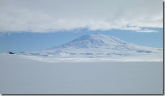
P1030583As an additional means of testing the ozone instrument, on Saturday, January 7th, we piled ourselves, our cold weather gear, and a test version of the instrument into a tracked vehicle called a Pisten Bully and headed out onto the ice shelf to deploy it in a remote location free of pollutants called Windless Bight. The Pisten Bully is a passenger carrying version of snow cats that groom ski hills and as such can trudge through any snow conditions but at a painfully slow pace. Two hours of rumbling and rattling over the snow later, we arrived at an instrument site on the ice that is configured to detect nuclear explosions anywhere on the globe, and within 30 minutes, the compact ozone instrument was securely mounted and collecting data. And true to form, the test unit proved its worth as its telemetry revealed an issue to Lars a week later back in the comfort of the Crary Lab. If the issue proved to be systematic, it would be important to understand it before all the systems were released to the wild, so on January 18th we set out on another 4 hour excursion in the Pisten Bully to the remote ice location. Fortune was on our side that day as the issue was determined to be fixable in software, and the day’s initially overcast weather gave way to reveal the towering Mount Erebus and Mount Terror high above us. Not only did we begin to accomplish our technical goals at Windless Bight, but much to my satisfaction, we also began to embark on our adventures to the ice.

P1030537Weeks of travel, hard work, and confined living conditions eventually took a toll on my body as it succumbed to the dreaded McMurdo Crud. During the first days of the cold, I suffered through sniffles and decreasing energy levels but eventually found myself bed ridden on my day off while others frolicked outside in the sunshine. While it pained me to spend my free time sleeping the day away, there was impending reward or punishment depending on how my body responded to the rest, since we were scheduled to fly to Marble Point the following day for our first real field installation. So after a full day of deliberate rest that allowed me to rally for the occasion, I found myself in that panicked state in the helicopter cabin on Monday, January 16 on my way to Marble Point. The cramped cabin was occupied by our team and another party of 3 and much to my chagrin, I was wedged tightly in the center of the craft where the views and photographic possibilities were extremely limited. Nonetheless, the half hour ride proceeded smoothly across the sea ice and then the helicopter pilot revealed the amazing capabilities of the craft as he glided effortlessly over acres of cliché Martian landscape in search of our desired installation site adjacent to the Wisconsin weather station. After a perfect touch down on a tent-site-sized landing spot, we efficiently gathered our personal belongings off to the side and awaited the arrival of a second helicopter that contained the power system equipment. In a scene reminiscent of the opening to TV’s M.A.S.H., we offloaded the equipment from the second copter while its rotor blades continued to spin over our heads. A few minutes later, we had collected all of our gear and the helicopter departed, leaving us alone on the Antarctic continent for the first time in a scene that we had rehearsed and anticipated so many times. After all of that preparation, the time had finally come to execute the plan.

Methodically, we set about building the frame and then found ourselves executing the one part of the plan we had not practiced already. On a continent known for extreme weather, the power system bears a striking resemblance to a ship with sail lofted, and the last thing we wanted was for the ozone system to be tumbling across the ice sheet like a sad, green port-a-potty on the side of I-80 in Wyoming. Two of the frame corners were near bedrock, so we drilled 1/2” diameter holes and inserted purpose-built rock bolts that provide ideal anchor points. The other two corners lacked bedrock, so we laboriously hammered 1-inch steel spikes a foot and a half into the ground and then attached the 4 corners of the frame to the anchors with chain. With that taken care of, we returned to our usual routine by adding solar panels, wind turbines, and the Hardigg cases to the frame. Then of course, we lugged 12 batteries and placed them in the Hardigg cases and began the careful procedure of electrically testing and connecting each component of the power system. In order to communicate the instrument data with the outside world, Lars connected the ozone station to an existing radio transmitter in the Wisconsin weather station and the instrument was finally powered on. Minutes later, it sprung to life with its familiar pump buzzing aloud just as it had done so many times in the lab before. The installation was complete after 5 hours with an hour to spare before the helicopter returned, so we casually explored the immediate area near the station where I was able to capture the panorama below.

The helicopter arrived on schedule, touched down in the same, miniscule landing zone, and we boarded with no more fan fare than hailing a New York taxi as the rotors whipped around over our heads. I was pleasantly surprised to find a more intuitive seat belt in this helicopter and was quickly fastened with none of the grief I experienced on the previous take off. The aircraft yawed and occasionally bucked in the wind as we cruised 600 feet above the sea ice, and my GPS confirmed the blustery conditions when I discovered that we were proceeding 30 mph slower than the 130 mph speed of the first leg. For the first time, I was able to enjoy the helicopter ride over the relatively featureless sea ice and my gaze out the window eventually discovered long, straight tracks that would eventually lead to seals near holes in the ice. Further inspection of the ground showed smaller tracks that I speculated were from penguins and with a few minutes remaining in the flight, I spotted 3 tiny penguins waddling their way along the ice. After a day spent in 16 mph, cool wind, I was ready to return home and the rapidly approaching view of McMurdo comforted me until the helicopter wildly swung to the left and to the right as if gripped by the wind itself. Fear began to set in, but I reminded myself that I was in the trusted hands of an experienced, professional pilot. No sooner had the turbulence started than he had the craft back under control for a safe landing. Half an hour later, we were back in the lab and Lars happily reported the first science data from the Marble Point ozone station!
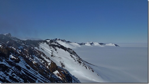
Minna Bluff and the Ross Ice ShelfEven with our first field installation under our belt, we weren’t resting on our laurels this past week as we disassembled the first Wisconsin frame for scheduled transport to the Minna Bluff site on Friday. But as often happens with flight schedules, Thursday’s foggy morning backed up flights and bumped our trip until Saturday, January 21. Only five days after our first install, I awoke feeling that I had finally recovered from the McMurdo Crud and readied myself for the day with a hearty, diner style breakfast consisting of sunnyside eggs, hashbrowns, and toast. And as we waited at the helicopter passenger terminal, I prepped myself by emptying Big Red of superfluous items that would interfere with the seat belt, then donned my helmet ahead of time, and only half jokingly went through the motions of putting on the 4 point seat belt. When the time came to board the chopper, I was ready and we effortlessly lifted off and floated across the dead-still sky towards our destination. The distant location of Minna Bluff necessitated a gorgeous flight path that toured us between White and Black islands and past Mount Discovery. Once again, the breathtaking views were difficult to capture on my camera from my interior seating location, but the experience of flight in such a majestic location was not lessened at all. The search for the actual weather station locations is a game that both pilots and passengers seem to truly enjoy as they buzz the ground and arc the machine in tight circles before finally lowering the skids softly to the rocks below.
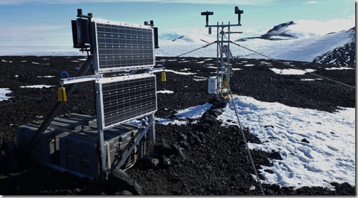
Completed ozone station (left) and the existing automatic weather station (right)As its name implies, Minna Bluff sits high above the sea ice on a coastline promontory akin to that of the British Isles that leaves it particularly susceptible to high winds that arrive unimpeded for thousands of miles along the continental ice. So whenever we discussed Minna Bluff, conversation turned to the gale force winds that we expected would complicate the installation effort. You can imagine our collective surprise when we disembarked the helicopter to find absolutely still air as reflected by the motionless anemometers on the weather station. Without a complaint, we quickly assembled the frame in the warm sunshine, and I even stripped down to a t-shirt during the aerobic spike-driving task. Our understanding of the power systems and each other became apparent as we efficiently divided tasks and made short work of the assembly. After 2 hours, the system was completely assembled mechanically, so we took a brief walk to the bluff’s edge where we enjoyed our lunch and views of endless white that eventually lead to the South Pole. Two hours later, the entire system was up and running and the wind had still not increased to more than a slight breeze. The fortunate conditions and early completion afforded us an opportunity to explore a little farther to another ridge point half a mile away where we took in the views and I shot the panorama below.

The efficient helicopter schedulers decided that our return flight could be combined with that of two more scientists up the coast, so after lift off, the helicopter followed an entirely new route along the termini of the famous Dry Valleys. With an empty helicopter, I was finally able to select a window seat and wisely chose the left side that provided views of my namesake Brown Peninsula and amazing glacial melt pools below. The other two passengers had spent the day surveying an area called Cape Chocolate, and the pea sized gravel bed provided no challenge for the pilot who easily set the craft down in the exact skid marks of his previous landing. In the air again and on our way back to McMurdo, I was amazed by the artistic, fractal patterns on the sea ice and happily took advantage of my excellent vantage point with nonstop shutter clicking of my camera that you can see in the photo slide show below or in a new window.

The warm, still air of the late day provided an effortless landing in McMurdo and minutes later in a tradition that will hopefully continue, Lars was able to report that he received science data from the Minna Bluff station and all was well! With our stay in Antarctica at exactly the half way point, it is encouraging to know that we have successfully completed half of the ozone station installations. We are certainly breathing a little easier, but there is more adventure so stay tuned…

Thursday, January 19, 2012

Ozone Depletion

Children are known for insatiable curiosity that manifests itself with endless questions of, “What is that?”, “How does that work”, and quite often the simple ponderance, “Why?” Although this behavior is most obvious in our developmental years, I can assure you that adults continue to ask these fundamental questions as I attempt to field responses regarding our scientific mission here in Antarctica.

Apart from the numerous questions I receive regarding Antarctica itself, the most common question concerns the purpose of our visit to this southern land. In a word, the answer is: ozone. While the stable, diatomic (O2) form of oxygen is undoubtedly everyone’s favorite atmospheric constituent due to our respiratory dependence on the molecule, its lesser known cousin, ozone, also plays a critical role in our atmosphere. Generally speaking, ozone is created when a single oxygen atom combines with our usual, diatomic (O2) oxygen to produce triatomic (O3) oxygen, better known as ozone.

When you hear the words Antarctica and ozone in the same sentence, you almost certainly think about the infamous “hole in the ozone layer”  above the continent. The ozone of this context exists tens of miles above the Earth in the stratosphere and is naturally created when ultraviolet light from the sun strikes O2 freeing up two oxygen atoms that then combine with O2 molecules to create O3. The specific size of the ozone molecule makes it a perfect optical filter for harmful wavelengths of ultraviolet (UV) light from the sun, without which we are subject to intense solar radiation linked to sun burns and even been skin cancer. This topic became wildly popular in the 1980’s when the “ozone hole” over Antarctica was discovered and ultimately linked back to chloroflourocarbons (CFCs) that act to catalyze the destruction of ozone back into diatomic oxygen (O2). Subsequent to this finding, CFCs were banned from aerosol hairsprays and spray paint, but the annual ozone hole remains until this day as the CFCs persist in the stratosphere. While the study of the Antarctic ozone hole is a fascinating subject worthy of in-depth study and discussion in its own right, the purpose of our Antarctic expedition has little to do with stratospheric ozone or the ozone hole.

Quite apart from the study of lofty stratospheric ozone, the other atmospheric location of interest for ozone study is in the layer of air in closest contact with the Earth’s surface known as the troposphere. Quite appropriately, it is termed ground level ozone or surface level ozone, and this is the subject of our scientific study here in Antarctica. Before considering ground level ozone in polar regions, it’s worth considering what we already know about ground ozone from our own direct experiences. From a sensory standpoint, we are all intimately familiar with the unique smell of newly created ozone after lightning accompanies a rain storm and which we associate with the fresh smell of rain. In a less positive sense, we often heed summertime warnings from news stations who report “dangerously high levels of ozone” and recommend that we fill our gas tanks in the evenings to avoid exasperating the problem.

Once again, although the molecule in these circumstances is identical to the one we are here to study, our familiar context is also generally unrelated to the surface level ozone phenomenon in Antarctica. Our familiar experiences are based on its presence in the mid-latitudes that is defined by a rich, complex environment that is inextricably tied to anthropogenic (man-made) influences. As you can imagine, with such a wide variety ozone creation sources and depletion mechanisms, it is incredibly challenging to ascertain the exact atmospheric chemistry that is in action. But imagine the antithesis, a location almost entirely independent of anthropogenic effects; a place that that feels like the clock was turned back on geologic time scales to an almost unrecognizable setting ideally suited to study natural processes without the complications of the post-industrial era; this is Antarctica.

If surface level ozone concentrations were a naturally constant value in the Antarctic, research would have concluded years ago, but as with most interesting stories, there is much more to be told. In fact, previous studies in the Arctic (northern polar regions) detected annual springtime depletion of surface level ozone which was later confirmed by short term studies in the McMurdo region of Antarctica. These mysterious depletion events were confounded by the addition of significant Arctic pollution but simultaneously raised eyebrows as direct corollaries to the stratospheric, springtime depletion events of the ozone hole. Furthermore, Arctic surface level ozone has been considered a potentially significant greenhouse gas in the region of the Earth that is most critically linked to global warming. Clearly, a more thorough understanding of this fundamental atmospheric chemistry was needed.

One day, amidst the sweltering summer heat of 2011, I began a conversation with my friend and LASP colleague, Lars Kalnajs, that I expected would follow our usual twists and turns from outdoor exploration to integration of Arduino microcontrollers into our vehicles. But to my surprise, he informed me that he and Linnea Avallone had received a grant from the National Science Foundation (NSF) to perform a first-of-its-kind, long-duration, distributed study of surface level ozone in Antarctica, and then he shocked me by extending an invitation to assist with the field installation of these instruments during January/February of 2012. After confirming my response to join this endeavor, I began to learn about the various scientific and engineering minutia required to perform these measurements.

In particular, previous studies seemed to indicate that the annual, springtime depletion of polar surface level ozone was related to extreme cold conditions near sea ice that allows nonreactive halogens (bromine) to become reactive catalysts for the destruction of ozone in an analogous manner to the extreme cold of polar stratospheric clouds that participate in ozone hole destruction. However, the specifics of whether this destruction was occurring locally, in direct contact with the sea ice or in a distributed manner was simply unknown. This fundamental, spatial question provided the impetus to simultaneously measure ozone across a network of sites that could be clearly understood in relation to each other. Fortunately, the University of Wisconsin operates a large network of automatic weather stations (AWS) throughout Antarctica that provide continuous data to atmospheric models of the area. In order to leverage these mature sources of data while providing a spatial distribution away from the sea ice, the instrument network was architected to place four ozone instruments adjacent to existing weather stations.

AWSmap

The instrument location closest to the sea ice is at the northern tip of Ross Island called Cape Bird where it is expected that representative depletion events commence. Then moving away from this source is a location on the main continent called Marble Point for the second station and moving farther along the continent is Minna Bluff for the third station. Finally, far removed from Cape Bird but isolated on the Ross Ice Shelf is Lorne, the site of the fourth station. Each of these sites already consists of an AWS large,steel tower with an anemometer, temperature sensors, assorted other meteorological devices, radio telemetry, a small solar panel, and a bank of rechargeable batteries.

Since the ozone depletion events occur annually and are measured relative to annual baseline values, the ozone instrument must perform measurements throughout the year and on a frequent basis. And unlike the relatively quick and simple measurement methods of the AWS, ozone measurement is far more complex with vacuum pumps, lasers, highly sensitive detectors, and specialized computers that orchestrate the activity. All of this technical complexity is usually encompassed in large, laboratory grade instruments that casually consume gobs of 120VAC wall power. However, on a continent whose environmental superlatives are comparable to that of deep space, instrument design becomes an even more formidable challenge. The ozone instruments for this campaign were custom designed, manufactured, assembled, and calibrated by Lars himself which is a technical feat considering that such endeavors are typically the products of entire teams of engineers and scientists. And while the instruments are optimized for minimal size and power consumption, they still require respectable amounts of power to run throughout the cold, dark months of the Antarctic winter. Fortunately, the AWS folks and another seasoned polar expert, UNAVCO, have previously addressed these challenges and were able to provide time-tested power system infrastructures for the ozone instruments. In contrast to the unassuming, boxy appearance of the ozone instruments, the power systems are in-your-face with large, aluminum, triangular frames that house two 80 watt solar panels, two compact wind turbines, and two waterproof Hardigg cases. And within these Hardigg cases are 12 sealed lead acid batteries, power distribution and charging electronics, and finally, the piece de resistance, the ozone instrument.

It is amazing that something so small and simple as an O3 molecule could inspire such dedicated efforts and studies, but the need to discover and learn is among our deepest human desires and like the Antarctic explorers who preceded us, huge efforts are clearly required to reach meaningful accomplishments. With each day we spend on the continent, we push harder and closer to our expedition’s goal to deploy the ozone monitoring network, so stay tuned to hear about the progress we have achieved during our time in Antarctica.

Thursday, January 5, 2012

A Week in McMurdo

Great light in the snow trench ceilingI awoke to silence and an oddly blue linear pattern of light above my head. Within moments I realized that I was buried under 5 feet of snow and was thousands of miles from civilization on the Ross Ice Shelf, but panic did not set in. Rather, I was filled with satisfaction knowing that I had spent a successful night in a weather-proof snow trench that I constructed the previous evening as part of Happy Camper School.

A week prior, I arrived in the tiny outpost of McMurdo station on the very edge of Antarctica and so far my experiences have varied from the inescapable monotony of trainings and briefings to the unexpected rip-roaring New Year’s Eve hoe-down called Ice Stock to productive scientific work and of course to spending two days camping on the ice shelf. My time thus far in McMurdo has left me buzzing from one thing to the next with little time for rest or quiet, but with countless opportunities to observe a world that is both foreign and familiar.

Since Antarctica resides on the dust-free side of the globe and has no entrants in the Olympics, it goes largely unnoticed by most of the world and is regarded as a mysterious land akin to Atlantis or another planet. Assuming you haven’t spent your evenings brushing up on Antarctic geography and history, I feel it is worthwhile to provide a little context on this continent. First off, it is a polar landmass that contains the majority of Earth’s fresh water ice on an actual continental plate at the south end of the world which contrasts greatly with the Arctic (northern) pole that is comprised of sea ice that is floating on the northern oceans. Second, it is the only continent which has no nations, although seven countries have staked sovereign claims to various longitudinal slices of the continent. This, combined with its extreme weather, lack of significant indigenous fauna and flora, and remote location have rendered it a continent of almost zero population. The people who do spend time on the continent are typically here for one of two reasons: to conduct scientific research or to support the scientists. Experiments are conducted throughout the continent in temporary field camps and at a handful of permanent research stations. The United States Antarctic Program (USAP) is a branch of America’s National Science Foundation (NSF) and represents the largest presence of any nation in Antarctica. USAP maintains 3 permanent research stations: South Pole Station, Palmer Station, and McMurdo Station. The location of the South Pole Station is equally obvious and awe-inspiring given the extreme cold and isolation; Palmer Station is located on the Palmer Peninsula, which is the long finger that reaches up towards the southern tip of South America; and finally, McMurdo is located almost diametrically opposite from Palmer at the edge of the Ross Sea and 2600 miles due south of New Zealand. Its exact location is on the edge of Ross Island just off the coast of the main continent in a historic location that was readily accessible by sea for the early Antarctic explorers.

Welcome to McMurdo!McMurdo is by far the largest of the Antarctic research stations with a summer population of 1000 and the largest collection of logistical resources. Prior to my arrival I read several accounts of Antarctica and McMurdo but Werner Herzog’s acclaimed documentary, Encounters at the End of the World, made the most significant impression on me. I knew that in addition to the obvious natural wonder that I would experience, the societal aspects of McMurdo would be worthy my attention during my 6 weeks in the small town. Countless times, I heard McMurdo described not as an exotic glaciated camp but as a grimy mining town you would expect to find in Alaska. If fact, this is a wonderful description, but its worth noting why this is the case. The specific site is on snow-free, solid volcanic land that is adjacent to sea ice that melts every summer providing seafaring access to resupply ships, and if you are looking to build permanent structures in Antarctica, those are two of the best characteristics you could hope for in a station site. Furthermore, although Ross Island is not technically connected to the main continent, it is effectively attached via the permanent Ross Ice Shelf that permits year-round ground travel to other locations. While the town setting is not particularly attractive, Mount Erebus (12,448’) dominates the view looking back along Ross Island while the TransAntarctic mountain range occupies the space above the sea shelf and sea ice in front of town. Without a doubt, the views are stunning.

McMurdo StationThe town itself is an eclectic mix of buildings that seem to be haphazardly placed on the volcanic rock as if tossed out by Erebus itself. Dormitories, two small bars, the Coffee House, a gymnasium, the Chapel of the Snows, and the galley all compete for the resident’s free time, but the business side of the station dominates the area. The station’s center piece, the Crary Lab, is the heart of the Antarctic scientific community and is proudly built on the hillside looking out at the TransAntarctic Mountains. It is a state of the art laboratory with technical resources, labs, and office space for the hundreds of visiting scientists who base their research in McMurdo and who use the town as a launch pad for the remote field camps.  The station has the feel of a university campus crossed with a military base and there are signs of this everywhere. Moving away from the university-esque Crary Lab, you find an entire support infrastructure right before your eyes with no place to hide on the bare volcanic grounds. Pipelines zigzag above ground to massive fuel tanks with millions of gallons of diesel, gasoline, and jet fuel while others carry waste heat to buildings and yet others carry waste liquid to the water treatment plant. Heavy equipment continuously drives the same dirt streets that residents walk on and provide support to three airfields on the ice and a heliport in town. There is a completely raw feel to it where science is the esthetic and architecture is not even an afterthought.

On my second evening, I hiked up Observation Hill and captured a dozen photographs that I stitched together into the 360 degree panorama seen below.

If you spend a few moments panning and zooming and have a keen eye, you just might be able to find the following local landmarks:

  1. This tribute to Captain Scott’s ill-fated trip to the South Pole is engraved with the words “To strive, to seek, to find, and not to yield.”
  2. The galley is the sole location for meals in McMurdo and chances are that the Smurfs would feel right at home in this building.
  3. Less than 2 miles away from McMurdo, New Zealand maintains Scott Base whose color you would expect from the Irish.
  4. The sea ice melts away for a few weeks each year right up to this location along the ice shelf. (Hint: it all looks like snow, but there is a clear delineation)
  5. The Kiwis and the Americans have recently begun to share this source of renewal power.

Ice Stock!Within a day of our arrival, I had already met two of the residents who were prominently featured in Encounters at the End of the World, and I was excited to explore the social aspects of McMurdo myself. With great fortune, we showed up in town to crystal blue skies and balmy, 32 degree temperatures that provided an ideal environment to celebrate the coming of the New Year at the stations biggest annual party, Ice Stock. For over 6 straight hours, bands rocked atop a temporarily erected tractor trailer stage while hundreds of folks danced and partied like it was the last day of the year. Each of these groups demonstrated surprising talent and at least as much initiative as they pulled together musicians from the McMurdo ranks with a wide array of instruments to entertain the troops for just one day a year. The faces of these musicians were among the first I saw at McMurdo, and I feel a bit like Herzog as I encounter them dishing food and sweeping halls for I have seen a side of them that draws their passion like their day-to-day job can not.

DJing 104.5And in a particularly Herzogian encounter right after Ice Stock, Sam and I met two residents who spend their spare evenings running the local radio station and were thrilled to share the radio business with us. We wandered down the hall from the galley with Matt and Tristen and right into the live radio booth where Matt promptly interviewed me and Sam queued up Neil Young. While that was a real treat, things then got really interesting as they described the McMurdo vinyl record collection that was provided ages ago by the Air Force Radio and Television Service (AFRTS). With the advent of digital media, all AFRTS vinyl collections were slowly phased out and destroyed over the years and now the sole collection in in existence resides in McMurdo. Apparently, the only reason it has survived is that all garbage must be shipped back to the states from Antarctica and the cost of shipping the record collection has been considered to be too large. However with limited physical space around town, there is a looming threat that the collection will meet its demise in the near future and this history will be lost forever. And this is where the encounter took a great turn; Matt and Tristen would like to see the vinyl collection maintained as historical records and are working to see if they can receive an appropriate protected status that allow this Antarctic oddity to survive well into the future.

Erecting a Scott tentOur days are typically filled with the business at hand which will quickly turn to several helicopter supported day trips to remote locations to install the ozone instrument network in the field. However, regulations will not let you go to the field without proper survival training for this harsh environment, so Sam and I were required to attend a two day class that is affectionately called Happy Camper School. After a morning-long classroom session, our class of 10 students and 1 instructor boarded a monster truck-esque shuttle vehicle and bounced 4 miles away from McMurdo and out onto the Ross Ice Shelf. From there we hiked another half mile to a desolate location with dead flat snow for miles in every direction and began our training in earnest. We established a temporary camp where we erected tall, pyramid Scott tents whose design has not changed in a century, and then proceed to construct a chest high snow wall as a wind break. The wall was composed of perfectly rectangular chunks of styrofoam-like snow that were literally cut from the ground using a hand saw. The uniform composition of the snow is like nowhere else on Earth and it was amazing to use snow in this way without any additional compaction or treatment. After we established that we could provide simple camp for ourselves, we were offered extra credit. As we were building our wall, the instructor had been quietly digging out an 8 foot long trench that looked frighteningly similar to a human grave, and then he proceeded to tell us that if we wanted to, we could sleep in one of these snow trenches instead of our perfectly good tents. This all sounded pretty ridiculous to me, but to be fair, the usual goal of a snow trench is to provide an emergency shelter that is free from the deadly effects of high winds. After a few minutes of hand waving instruction on how to finish building a snow trench, he left us to fend for ourselves for the night. Never one to shy away from I challenge, I grabbed a shovel and spent the next 4 hours shoveling away until I had a comfortable sleeping chamber free from the wind, but covered in blocks of snow that seemed to be precariously suspended above my head. However, once I moved into my abode and spread out my gear, it took on the feel of a nest and I slept soundly throughout the night. The following morning, we broke camp and proceeded learn about VHF & HF radio usage and practice scenarios. The scenarios were not only instructive, but quite entertaining as we attempted to contact the South Pole using Korean War era radio equipment and then simulated white-out conditions with plastic buckets on our heads. I have always been one who loves to camp, and it’s pretty darn cool to be able to say that I am an Antarctic Happy Camper.

As usual, enjoy the photos in the slide show below and if you would like to open this slideshow in a new window, just click here.

For an additional perspective on the past week here, check out the following excellent posts from Sam Dorsi: Back From Happy Camper through Ridgeline North of McMurdo

Sunday, January 1, 2012

Taking Stock and Ice Stock

P1030432Occasionally, habits are formed that are actually beneficial. One such habit of mine is to reflect upon each year in writing with the goal of improving myself and creating a sense of accountability. For each of the previous 3 years, I clearly stated goals and set about achieving them over the course of year, and on this first day of 2012, I find myself in need of this habitual reflection and goal setting.

In my pursuit of this past year’s goals, I learned two important lessons regarding goals. First, I learned that goals are all about spending most of your time doing things you don't want to do so that you can say you did something that you did want to do. Second, I learned that goals need to be continuously reevaluated and correspondingly adjusted to the twists and turns of life.

Friday, December 30, 2011

Antarctic Arrival!

P1000367Months of anticipation were finally satiated by our arrival in Antarctica last night! Following numerous flight delays to our previously scheduled December 28th departure due to foggy conditions in McMurdo, we were finally manifested on an LC130 instead of the C17 and the wheels left the tarmac at 1:23pm bound for the Great White South. The propeller-driven LC130 is significantly smaller than the jet powered C17 and is fitted with skis in order to simplify landing conditions on the Ross Ice Shelf near McMurdo, but with a resultant increase in noise and a longer duration flight. None of that mattered to me though; I was on an adventure and completely relished every aspect of the journey.

The two dozen passengers sat in jump seats along the inside walls of the plane’s fuselage which in combination with our extreme weather clothing (ECW) heightened the sense that we were embarking on a mission of utmost importance. We floated through the skies in the giant leviathan with roaring engines too loud for even a single conversation. The surreal experience eventually gave way to the realization that we were over the continent and closing in on our destination. Shoulders were pressed side by side as we busily fired off photographs of the fractaled ice below through the tiny port hole windows, and we even occasionally had the privilege of joining the pilots in the cockpit for a few minutes of 180 degree panoramic scenery. After 7 hours of flight, we were back in our jump seats and without a view of the approaching ground. The sound of flaps and landing gear deploying was accompanied by corresponding changes to airspeed and aircraft orientation, but it was always nervous not being able to see the ground throughout the descent. Finally, the plane touched down and the graceful landing was subtly punctuated by the sound of skis chattering on the snow. We had made it safely to Antarctica!

Minutes later, we had all disembarked and found ourselves standing with our very own feet on the Ross Ice Shelf just off the main continent and Ross Island. We slowly turned in circles trying to absorb the surroundings, but there was simply not enough time, so instead we boarded vehicles that would carry us 50 minutes across the ice to McMurdo. The Delta vehicle was an airport shuttle bred with a monster truck and was typical of the vehicle abnormalities that we were about to see throughout McMurdo. As we were cruising slowly down the flagged ice road, our driver suddenly stopped to give us a chance to meet and greet our welcoming party. Two Adelie penguins trotted along the ice in an uncharacteristic location displaying their adorable waddle/run antics. Without a doubt, we had arrived in Antarctica.

Click here to view the photo album in a new window.

If you would like to read Sam Dorsi’s perspective on our arrival, head on over to this post on his blog.

Tuesday, December 27, 2011

A Kiwi Christmas

This holiday season, I feel great sympathy for Santa Claus and the extreme journey he takes around the globe each year as he delivers presents to all the children of the world. My own journey may not have been quite as arduous as Saint Nick’s, but traveling half way around the world for over 24 hours straight at Christmas time was still quite ambitious and worth every minute. Instead of finding neatly wrapped presents under a tree in my living room, my gift was a few days on the warm sand of New Zealand under the indigenous Kiwi Christmas trees!

This brief pit stop on the North Island was a great way for Lars, Sam, and I to take some personal time and break up the long monotony of air travel on our way to Antarctica. We arrived in Auckland midday on December 24th after losing a day at the International Date Line and proceeded directly to Waihi Beach at the north end of the Bay of Plenty. This sleepy beach town was in the midst of experiencing exceptionally nice weather which made the stunning coastline appear all the more breathtaking. The laid back attitude of the beach town was easy to adapt to during our first day, and we continued to enjoy this easygoing life on Christmas Day during a gorgeous hike up the coast to another cove and a tropical waterfall. Kiwi families were out and about on the trails and beaches after celebrating Christmas at home in the morning which was an interesting contrast to our usual expectations of a Christmas afternoon spent in the snowy North. Be sure to check out the photos below, or click here to open the photo album in a new window.

Colonial British countries, including New Zealand, have instituted a holiday immediately following Christmas called Boxing Day. Apparently this day’s name is derived from boxing up donations to send to charity after experience great wealth the day prior, but I think it is more likely just a great reason to keep the holiday season momentum going. Our last full day of vacation was spent celebrating Boxing Day with throngs of tourists and locals alike at a curious natural feature up the coast on the Coromandel Peninsula called Hot Water Beach. The ocean’s edge in this location just happens to coincide with a geothermal site that heats subsurface water and drives it up to the surface much like the thermal pools in Yellowstone National Park. However, the exact locations of the hot springs are limited to a few hundred square meters and are only accessible within 2 hours of low tide, so when tourists descend on Hot Water Beach, they do so in throngs. And when you add the fact that it was Boxing Day when we visited this attraction, you can only imagine the mad scene that ensued. In fact, the experience was both simultaneously hectic and ordered in the way of a beehive. After I caught a few waves on a rented surfboard, I perched my GoPro on a precipitous cliff high above the scene and captured this panoramic time lapse that does a nice job of conveying the natural and cultural oddity of Hot Water Beach.

We knew that our days on the beach were limited, and this morning we parted with the Bay of Plenty for a quick, 1-hour flight to Christchurch on the South Island which is our launching point to Antarctica. Upon arrival at the Christchurch airport, we were greeted by a representative from the United States Antarctic Program (USAP) who briefed us on our schedule for the next two days and warned us that aftershocks are persisting from last week’s earthquake. The news was not meant to be frightening, but it was a somber reminder of the natural disasters that have struck this city twice in the past year. Although we had heard of the damages the city had sustained, we boarded a bus to view them first-hand. Initially, we concluded that perhaps the damage was not as bad as reported, but upon further exploration, we came across a city that looked war-ravaged with closed streets and fatally compromised structures. The downtown was barely passable as a place worth visiting at all, but farther away, the smaller buildings showed less damage. Unfortunately, the city’s namesake church was irreparably destroyed in last year’s earthquake when its high steeple toppled to the ground, and now construction towers scrape the sky in its absence. On a more positive note, the Canterbury Museum survived these recent natural onslaughts, so we are planning on a quick visit to it and the adjacent, lush botanical gardens tomorrow morning prior to our departure to the cold, white South.

In 24 hours, I will be stepping foot on the most remote, the highest, driest, windiest, oddest, and of course, the coldest continent on the planet- Antarctica! Stay tuned!

If you’d like to read Sam Dorsi’s perspective, head on over to this post on his blog.

Wednesday, December 21, 2011

See You on the Flipside

usaplogolargeToday marks the 2011 Winter Solstice which means the days are getting longer in the U.S., but in my case, the days are about to get much longer. Rather than a paltry 10 hours of daylight per day, starting today I am embarking on a journey that will be providing continuous, 24 hour-per-day sunlight! If your physical geography lessons are still fresh in your mind, then it won’t be too difficult to solve the puzzle of how I am about to affect this change. That’s right, I’m going to Antarctica!

It is going to be a topsy-turvy trip akin to Alice’s fall down the rabbit hole during which my 24+ hour travel will result in a complete loss of a calendar day (only 364 days in 2011 for me) and an almost immediate transition from winter to the Austral summer where I will be hanging by my feet upside down on that quirky side of the planet. Apparently, our old friend Coriolis will make the toilets flush backwards and the sun will traverse the sky counter-clockwise. It truly will feel like a upside down, mixed-up Wonderland.

This incredible opportunity presented itself this summer when my friend and colleague at LASP, Lars Kalnajs, asked if I might be interested in joining him and another friend and colleague, Sam Dorsi, on a campaign to install and test ground ozone monitoring stations in remote locations on Antarctica. First off, if these names ring a bell, it’s because these two guys are the same characters with whom I launched 3 balloons to the edge of space in 2010! One of the most important lessons I learned from those adventures is the incredible importance of working well with others in challenging situations; and I knew that if I had an opportunity to work with them again in the future, I wouldn’t blink an eye. So when this proposal was put on the table, my answer required no deliberation: Of course I wanted to join this expedition to the far reaches of the Earth!

The details of this scientific enterprise will be addressed in future posts, but I’m sure you’re wondering where exactly we’ll be going, how long we will be going, etc. Our research campaign will be based out of McMurdo Station which is the largest such research station (~1000 people), which by extension also makes it the largest settlement in on the continent, since Antarctica is a continent of science only! The launching point for McMurdo is 6 hours north in Christchurch, New Zealand, but international flights only go to Auckland on the North Island of NZ which are 14 hours from LA which is 3 hours from Denver. As you can see, it is quite a journey just to get to Antarctica, but compared to the epic journeys of the early polar explorers, this trip is a breeze. The additional complications of the holiday season helped dictate a slightly early departure from Denver with the added benefit that we will get to explore a sliver of New Zealand over the Christmas weekend before getting down to business on the icy continent. After the quick holiday, we will hop our flight down to Christchurch where we will deal with the final logistics before boarding a C17 military transport on December 28th for the actual flight to the ice. Upon arrival at McMurdo, more logistics and training will ensue before we can finally begin our work in earnest. We will then spend 5 weeks preparing the ozone instrument stations and deploying one per week in remote locations in the vicinity of McMurdo. Then finally in mid-February after the scientific campaigns have been completed, we will fly back to Christchurch where I will vacation with the Kiwis for a few weeks. Finally, in mid-March I will return home to Colorado.

My departure from Denver is imminent, and I must admit that the build up to the trip is like nothing I have ever experienced. I have pored over books and movies of the great white South, and have pictured myself a thousand times on the exotic continent of Antarctica. In my mind, this is the trip of a lifetime and is like going to the Moon or Mars to me. And like the pioneering polar explorers, the Apollo astronauts, and the Mars rovers, I aim to document my experience to my full capacity. My gear packing is short on clothes, but long on electronic gadgets. I have no fewer than 6 GPS devices, 5 cameras, 2 panoramic time lapse rigs, and a fully autonomous unmanned aerial vehicle (UAV) with onboard video that I will be exploiting to the fullest to capture my experience of Antarctica. This adventure will certainly be the essence of my website title as I share my stories and explore technological means of sharing those stories.

Although I am skeptical of its performance in Antarctica, I will be checking in periodically using my SPOT Messenger which will update the map below. So sit back, sign up to follow this blog (top right of the webpage), and enjoy our expedition from your favorite easy chair!

Monday, December 12, 2011

Bixler GoPro

BixlerGoProFor the second Saturday in a row, I had some fun mounting my new GoPro Hero2 onto something unique in order to capture a cool vantage point. This time, I attached the camera to my stock Bixler remote control (RC) airplane and launched it into the wild blue yonder! If it seems like I’ve done this before, it’s because I flew Gumby on my old EasyStar plane just before Christmas 3 years ago. And if you remember that video, you also remember that the quality was far from perfect due to the live streaming downlink I used at the time. Well now that I have a high-definition GoPro, there’s no excuse for grainy video anymore, but as I found out, the quality still wasn’t quite perfect. I shot all of these clips in the 1080 30fps mode with full-width 170 degree field of view and you can certainly see the significant fisheye distortion along the horizon lines, so the next time I fly, I’ll try the slightly narrower 127 degree field of view which should significantly decrease the distortion. Another minor gripe is that the vibration of the electric motor resulted in a slight “jello-effect” if you look closely, but I’m hoping that the anti-vibration plug accessory will cut down on that on future flights. On the plus side, the plane flew extremely smoothly and there was no need to stabilize the video digitally in my video editing software. Overall, I’m thrilled with the footage from my first 4 flights and can’t wait to fly again!

And if you’re interested in how I mounted the camera, it really couldn’t have been easier. I reused the display mount from the packaging and simply trimmed it to fit within the cockpit area. In order to attach it, I wrapped two of the 2-sided velcro straps around the camera plate and the fuselage and voila, instant GoPro mount for my RC plane!

Saturday, December 3, 2011

GoPro Hero2 camera

I finally bought a GoPro helmet camera and have been dying to try it out. Unfortunately, it’s been a little too chilly to kayak and I’m not quite ready to mount it on my RC plane or quadcopter, but I’ve always wondered how River Dog sees the world. So this morning I had a little fun playing with the new camera and then figured out how to use my new PowerDirector video editing software. Check out the morning from River’s perspective:

IMG_1341Although this is my first GoPro helmet-cam, it isn’t my first helmet-cam, nor is it my first GoPro. Over a decade ago, I rigged up a helmet-cam by mounting a spy camera in a headlamp with wires and batteries that hung off my head and led down to a full size camcorder that was stashed in my backpack. At the time, it seemed pretty innovative compared to the previous standard of mounting an entire camcorder to your helmet! It also isn’t my first GoPro. Before they became the unanimous leader in point-of-view (POV) digital cameras, they sold inexpensive waterproof film cameras at whitewater rafting gift shops. It’s impressive to see that waterproof enclosure design has barely changed in all these years while the digital technology of today was unthinkable a decade ago. So far I’m really impressed with the Hero2 from GoPro, and I’m thrilled to add it to my camera quiver! You will be seeing lots more footage from in the coming months and years!

Saturday, November 26, 2011

New Front Porch

Autumn seems to be drawing to a close in Colorado, and I am happy to have completely wrapped up the reconstruction of my front porch. This was yet another of my many New Year’s Resolutions for 2011 that I’m proud to have finished. As you see in the photo album, I replaced the worn out decking with beautiful redwood and opted for the heartwood which is all red for a very clean look. I finished it with a teak colored stain that blends well with the brown building colors, and I fastened the boards from below which results in a smooth top surface and extra protection against rot, since water doesn’t pool in each of the screw holes on the decking. The railings were also rotted, so I replaced them with durable redwood which was painted brown to conform with the condominium colors. As always, the project required much more energy and time than I expected, but I love the finished product.

Sunday, November 20, 2011

Time Lapse Photography

To continue with my recent theme of technology articles, it seems appropriate to touch on another interesting photographic method-- time lapses. You’ve seen them on TV more times than you can count, but I doubt you have ever created one. Depending on the hardware you have, it may be a simple or complex endeavor, but it can be quite fun and can potentially reveal something that would be difficult to observe otherwise.
One of my favorite time lapses is shown in the video below and reveals significant motion of an iceberg in Alsek Lake in Alaska over a the course of about 2 hours. This scene is particularly interesting to me, because as I sat on the shore of this incredible lake with my friends for several hours, we would occasionally note that the massive icebergs had moved significantly right before our eyes without any perceptible motion. So in the remaining day light hours, I captured this berg’s motion and confirmed that it was indeed moving quite a bit right in front of us.

Friday, November 18, 2011

Panorama Creation

We’ve all seen beautiful panoramic photos that capture sweeping landscapes and have probably experienced 3D tours on real estate websites that let you look in different directions around the rooms of the house. Although these technologies are widespread, they are not widely used by the layperson to share their own experiences of the world. Given my interest in exploring different ways to tell stories digitally, I thought it would be worthwhile to explore the realm of digital panorama creation.


The basic process of creating panoramas can be summarized in a few steps, each of which I will explore in more detail:
  1. Capture the scene by taking multiple overlapping photographs
  2. Stitch the photos into a panorama
  3. Share the panorama with viewers

Thursday, November 3, 2011

Video Editing Software Comparison

As part of my effort to explore the many ways that digital media can be used to share stories, I have invested considerable time and energy creating small videos that I have posted to my YouTube channel. These videos have ranged from my favorite clip of a humpback whale to Gumby flying my RC plane to time-lapses of space-borne scientific instruments to photo/video montages of my kayaking exploits. But no matter the subject, the fact remains that being able to quickly and repeatedly generate content is the best way to share the story behind the video. In order to accomplish this throughput, I have used Windows Live Movie Maker as my video editor for the past several years. It is an extremely simple, yet robust, free video editor for Microsoft Windows that is analogous and quite comparable to iMovie for Mac computers. But after a while, simply being able to generate content consistently was no longer enough. After spending all of that time creating videos, I realized that there were capabilities that simply did not exist in Movie Maker and so I set about to find a better solution.

Sunday, October 30, 2011

2011 Summer Recap

We all knew that 2011 would be a year for the record books in the Colorado kayaking world, but none of use knew exactly how it would turn out. After an absolute whirlwind the past several months, I finally have a few moments to recap some of the most memorable trips from this exciting kayaking season!
During the month of May, I spent almost every waking minute that I wasn’t working on my van installing the turbo charger and the solar panels, so I didn’t have much to show for kayaking, but on Sunday the 22nd, I had the opportunity to join some friends on the Upper North Fork of the Poudre River which is a beautiful wilderness run that cuts through the rolling grasslands north of Fort Collins and just south of Wyoming. We had plenty of adventure including extraction of a kayak that was pinned on a log above a class V waterfall. The day was beautiful and the photos actually do the scenery justice quite well, so be sure to check them out in this photo album.

roadtrilplogo3

Wednesday, October 19, 2011

New Fence

P1030300Some projects take a little longer to complete than others, but what matters is that they are actually completed. Shortly after finishing the installation of my new floors early in the year, I decided to tear down my fence and build a new one. At the time, I thought it would take a weekend or two, but the fence posts were a nightmare to replace, then I installed the turbocharger and solar panels in my van, and finally set about kayaking 100 days! So it wasn’t that I was lazy, I just had other activities that were higher priority than building a new fence. All summer long, I kayaked every spare minute and my little yard remained in shambles with posts sticking high out of the ground. I finally returned to the fence project after a 5 month sabbatical and set about rebuilding it every day after work with my headlamp lighting my work well into the evening. The fence has been completed for 2 weeks now and I’m thrilled with the results. Take a look at the embedded photo album below to see the whole process from old to new, or check it out in a new window